Piploda night lights from space
Night Light of Piploda (Madhya Pradesh) from space (India) Src. Average luminocity for 10x10km area is 4.0777% and for 50x50km: 5.7744%.
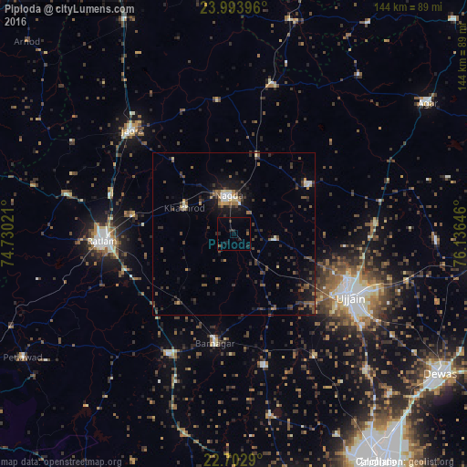
Analysis of Piploda night lights 2016
Square area 10x10 km:
 0%
0%90-99
0%80-89
0%70-79
0%60-69
0%50-59
1.52%40-49
0%30-39
0.76%20-29
4.92%10-19
1.7%0-9
91.1%Square area 50x50 km:
0.24%90-99
0.48%80-89
0.48%70-79
0.31%60-69
0.64%50-59
0.93%40-49
1.52%30-39
1.82%20-29
2.53%10-19
4.35%0-9
86.71%Clear (daylight) street map image can be seen on geolist.org.
Map coordinates:
23° 59' 38.3" North, 74° 43' 48.8" East
23° 21' 0" North, 75° 25' 60" East
22° 42' 10.4" North, 76° 8' 11.3" East
Some cities around Piploda sort by population:
• Ujjain
39.7 km =24.7 mi,  118°
118°
• Ratlām
40.2 km =25 mi,  266°
266°
• Nagda
12.2 km =7.6 mi,  352°
352°
• Khāchrod
17.5 km =10.9 mi,  297°
297°
• Unhel
12.9 km =8 mi,  95°
95°
• Gautampura
41.3 km =25.7 mi,  167°
167°
• Namli
40 km =24.9 mi,  287°
287°
• Gogāpur
24.6 km =15.3 mi,  20°
20°
1259571 (p: 7,719)
Sources (retrieved 2019-11-25):
» Earth at Night: Flat Maps 2012, 2016