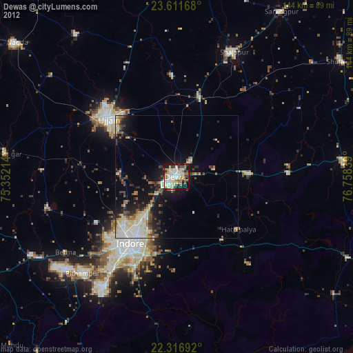
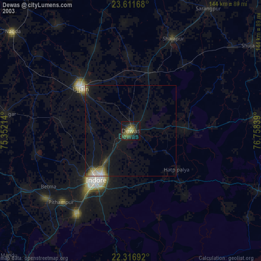
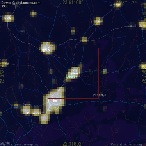
Dewas night lights from space
Night Light of Dewas (Madhya Pradesh) from space (India) Src. Average luminocity for 10x10km area is 75.6567% and for 50x50km: 25.2608%.
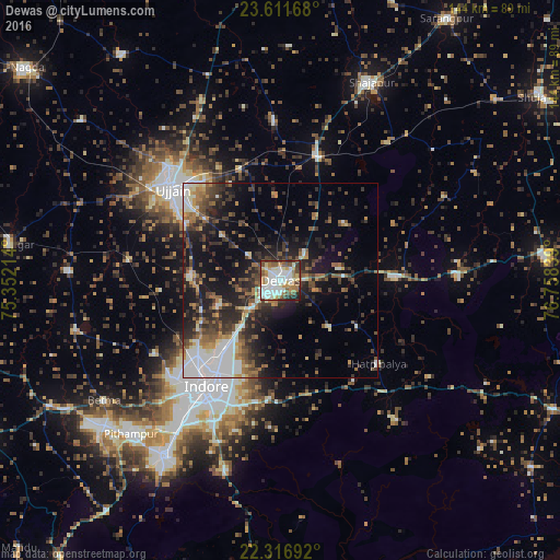
Analysis of Dewas night lights 2016
Square area 10x10 km:
 20.24%
90-99
25.4%80-89
8.13%70-79
6.35%60-69
11.71%50-59
8.33%40-49
9.33%30-39
4.56%20-29
5.36%10-19
0.6%0-9
0%Square area 50x50 km:
4.06%90-99
4.8%80-89
1.74%70-79
2.08%60-69
3.43%50-59
3.84%40-49
4.72%30-39
5.48%20-29
8.02%10-19
13.19%0-9
48.63%Clear (daylight) street map image can be seen on geolist.org.
Map coordinates:
23° 36' 42" North, 75° 21' 7.7" East
22° 57' 57.1" North, 76° 3' 18.9" East
22° 19' 0.9" North, 76° 45' 30.2" East
Some cities around Dewas sort by population:
• Indore
35.7 km =22.2 mi,  219°
219°
• Ujjain
37.3 km =23.2 mi,  310°
310°
• Tarāna
40.9 km =25.4 mi,  358°
358°
• Maksi
34 km =21.1 mi,  15°
15°
• Sānwer
23.4 km =14.5 mi,  272°
272°
• Hātod
37.6 km =23.4 mi,  239°
239°
• Iklehra
39.8 km =24.7 mi,  59°
59°
• Iāwar
45.9 km =28.5 mi,  83°
83°
1273066 (p: 261,218)
Sources (retrieved 2019-11-25):
» NASA, Earths city lights 1995
» NASA city lights 2003
» Earth at Night: Flat Maps 2012, 2016