Titābar night lights from space
Night Light of Titābar (Assam) from space (India) Src. Average luminocity for 10x10km area is 1.4223% and for 50x50km: 3.9552%.
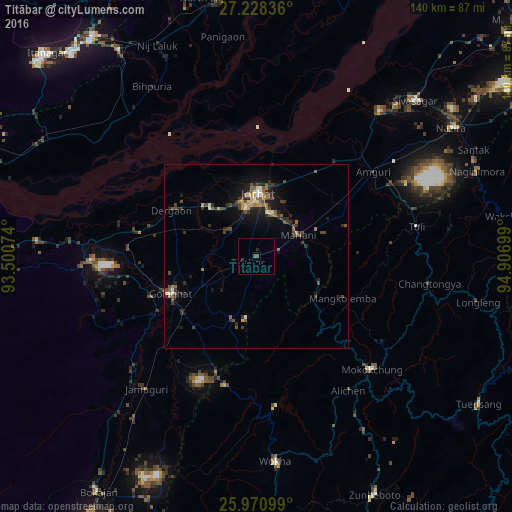
Analysis of Titābar night lights 2016
Square area 10x10 km:
 0%
0%90-99
0%80-89
0%70-79
0%60-69
0%50-59
0%40-49
1.52%30-39
0.76%20-29
0.57%10-19
0.19%0-9
96.97%Square area 50x50 km:
0.14%90-99
0.49%80-89
0.33%70-79
0.31%60-69
0.51%50-59
0.73%40-49
1.15%30-39
0.93%20-29
1.45%10-19
2.55%0-9
91.41%Clear (daylight) street map image can be seen on geolist.org.
Map coordinates:
27° 13' 42.1" North, 93° 30' 2.7" East
26° 36' 5" North, 94° 12' 13.9" East
25° 58' 15.6" North, 94° 54' 25.2" East
Some cities around Titābar sort by population:
• Jorhāt
17.4 km =10.8 mi,  359°
359°
• Golāghāt
26.3 km =16.3 mi,  247°
247°
• Mokokchūng
43.9 km =27.3 mi,  134°
134°
• Mariāni
12.7 km =7.9 mi,  60°
60°
• Dergaon
26 km =16.2 mi,  294°
294°
• Amguri
39.8 km =24.7 mi,  53°
53°
• Barpathār
47 km =29.2 mi,  221°
221°
• Numāligarh
47.9 km =29.8 mi,  272°
272°
1254310 (p: 7,836)
Sources (retrieved 2019-11-25):
» Earth at Night: Flat Maps 2012, 2016