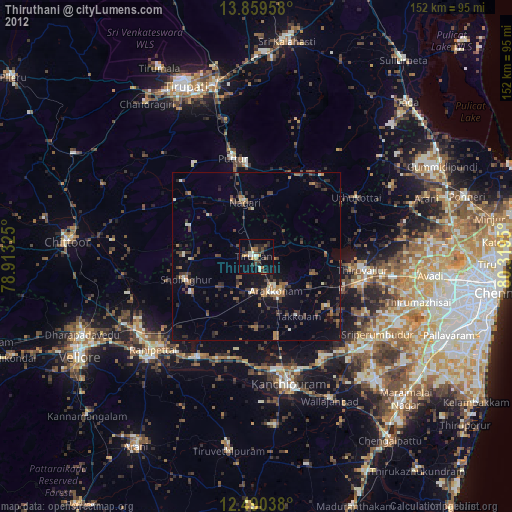
Thiruthani night lights from space
Night Light of Thiruthani (Tamil Nadu) from space (India) Src. Average luminocity for 10x10km area is 38.3701% and for 50x50km: 13.1537%.
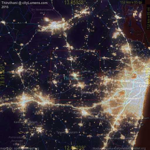
Analysis of Thiruthani night lights 2016
Square area 10x10 km:
 2.16%
2.16%90-99
4.76%80-89
5.84%70-79
3.03%60-69
5.63%50-59
10.61%40-49
8.66%30-39
9.96%20-29
11.69%10-19
34.85%0-9
2.81%Square area 50x50 km:
0.1%90-99
0.72%80-89
1.28%70-79
1.05%60-69
1.52%50-59
2.39%40-49
3.94%30-39
3.82%20-29
5.42%10-19
13.49%0-9
66.28%Clear (daylight) street map image can be seen on geolist.org.
Map coordinates:
13° 51' 34.5" North, 78° 54' 47.7" East
13° 10' 33.4" North, 79° 36' 58.9" East
12° 29' 25.4" North, 80° 19' 10.2" East
Some cities around Thiruthani sort by population:
• Arakkonam
11.7 km =7.3 mi,  150°
150°
• Tiruvallur
31.9 km =19.8 mi,  96°
96°
• Puttūr
30.4 km =18.9 mi,  346°
346°
• Walajapet
38.9 km =24.2 mi,  224°
224°
• Sholinghur
22.2 km =13.8 mi,  253°
253°
• Nagari
16.5 km =10.3 mi, 348°
• Nārāyanavanam
27.9 km =17.3 mi, 353°
• Pallipattu
25.9 km =16.1 mi,  314°
314°
1254342 (p: 39,899)
Sources (retrieved 2019-11-25):
» Earth at Night: Flat Maps 2012, 2016