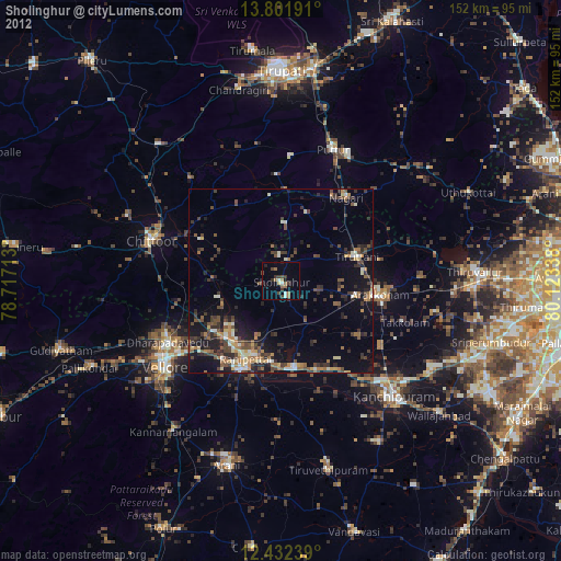
Sholinghur night lights from space
Night Light of Sholinghur (Tamil Nadu) from space (India) Src. Average luminocity for 10x10km area is 22.2165% and for 50x50km: 18.9992%.
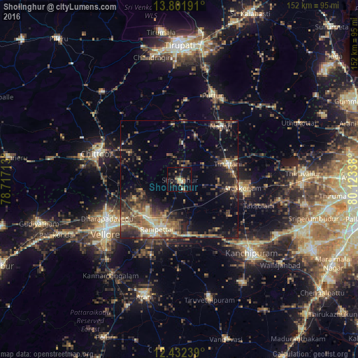
Analysis of Sholinghur night lights 2016
Square area 10x10 km:
 0%
0%90-99
1.52%80-89
4.55%70-79
1.73%60-69
6.06%50-59
0.87%40-49
5.19%30-39
4.98%20-29
5.84%10-19
21.86%0-9
47.4%Square area 50x50 km:
0.14%90-99
2.24%80-89
3.09%70-79
1.73%60-69
2.97%50-59
4.1%40-49
5.55%30-39
4.83%20-29
6.09%10-19
10.23%0-9
59.03%Clear (daylight) street map image can be seen on geolist.org.
Map coordinates:
13° 48' 6.9" North, 78° 43' 1.7" East
13° 7' 5.2" North, 79° 25' 12.9" East
12° 25' 56.6" North, 80° 7' 24.2" East
Some cities around Sholinghur sort by population:
• Arakkonam
27.4 km =17 mi,  97°
97°
• Arcot
26 km =16.2 mi,  204°
204°
• Thiruthani
22.2 km =13.8 mi,  73°
73°
• Rāmāpuram
25.6 km =15.9 mi,  265°
265°
• Walajapet
22.2 km =13.8 mi, 195°
• Nagari
28.8 km =17.9 mi,  38°
38°
• Pudūr
32.8 km =20.4 mi,  245°
245°
• Pallipattu
24.7 km =15.3 mi,  6°
6°
1256435 (p: 28,645)
Sources (retrieved 2019-11-25):
» Earth at Night: Flat Maps 2012, 2016