Pallipattu night lights from space
Night Light of Pallipattu (Tamil Nadu) from space (India) Src. Average luminocity for 10x10km area is 7.7293% and for 50x50km: 9.4964%.
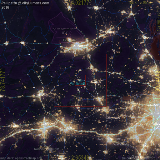
Analysis of Pallipattu night lights 2016
Square area 10x10 km:
 0%
0%90-99
0%80-89
0%70-79
0.41%60-69
2.48%50-59
0%40-49
3.31%30-39
4.96%20-29
1.24%10-19
3.31%0-9
84.3%Square area 50x50 km:
0.08%90-99
0.6%80-89
0.91%70-79
0.55%60-69
1.02%50-59
1.9%40-49
2.71%30-39
2.84%20-29
3.65%10-19
8.97%0-9
76.75%Clear (daylight) street map image can be seen on geolist.org.
Map coordinates:
14° 1' 18.4" North, 78° 44' 30.4" East
13° 20' 19" North, 79° 26' 41.6" East
12° 39' 12.6" North, 80° 8' 52.9" East
Some cities around Pallipattu sort by population:
• Tirupati
33.1 km =20.6 mi,  355°
355°
• Thiruthani
25.9 km =16.1 mi,  134°
134°
• Puttūr
16.4 km =10.2 mi,  45°
45°
• Sholinghur
24.7 km =15.3 mi,  186°
186°
• Nagari
15.3 km =9.5 mi,  97°
97°
• Akkarampalle
34.7 km =21.6 mi, 355°
• Nārāyanavanam
18.3 km =11.4 mi,  58°
58°
• Narasingāpuram
33 km =20.5 mi,  335°
335°
1260683 (p: 8,912)
Sources (retrieved 2019-11-25):
» Earth at Night: Flat Maps 2012, 2016