Tarakeswar night lights from space
Night Light of Tarakeswar (West Bengal) from space (India) Src. Average luminocity for 10x10km area is 23.6032% and for 50x50km: 20.6664%.
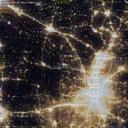
Analysis of Tarakeswar night lights 2016
Square area 10x10 km:
 0.6%
0.6%90-99
1.59%80-89
0.79%70-79
2.18%60-69
0.99%50-59
3.57%40-49
7.54%30-39
10.91%20-29
12.9%10-19
40.48%0-9
18.45%Square area 50x50 km:
0.29%90-99
1.76%80-89
1.75%70-79
1.88%60-69
2.53%50-59
4.89%40-49
6.01%30-39
6.83%20-29
9.73%10-19
19.1%0-9
45.25%Clear (daylight) street map image can be seen on geolist.org.
Map coordinates:
23° 31' 56.2" North, 87° 18' 37.8" East
22° 53' 9.8" North, 88° 0' 49.1" East
22° 14' 12.3" North, 88° 43' 0.3" East
Some cities around Tarakeswar sort by population:
• Arāmbāgh
23.6 km =14.7 mi,  269°
269°
• Singur
23.7 km =14.7 mi,  111°
111°
• Srirāmpur
7 km =4.3 mi,  4°
4°
• Kesabpur
27.1 km =16.8 mi,  70°
70°
• Bāgnān
13.8 km =8.6 mi, 67°
• Gangadharpur
25.4 km =15.8 mi,  123°
123°
• Haripur
23 km =14.3 mi,  76°
76°
• Rāmnagar
26.7 km =16.6 mi, 116°
1254912 (p: 30,475)
Sources (retrieved 2019-11-25):
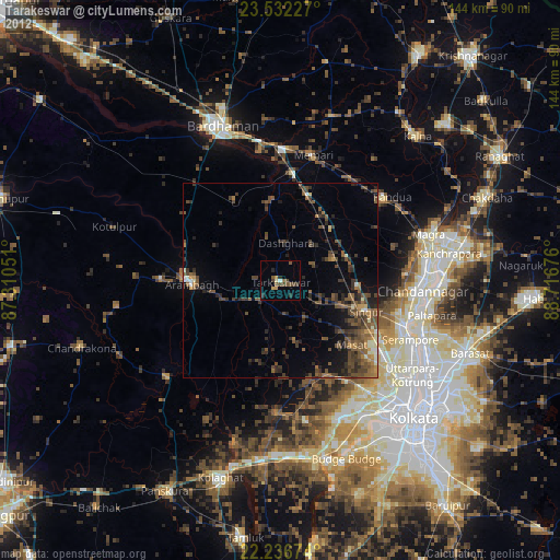
» Earth at Night: Flat Maps 2012, 2016