Kesabpur night lights from space
Night Light of Kesabpur (West Bengal) from space (India) Src. Average luminocity for 10x10km area is 14.8929% and for 50x50km: 41.3573%.
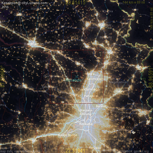
Analysis of Kesabpur night lights 2016
Square area 10x10 km:
 0%
0%90-99
0%80-89
0%70-79
0.2%60-69
1.79%50-59
1.39%40-49
5.36%30-39
6.94%20-29
9.13%10-19
21.23%0-9
53.97%Square area 50x50 km:
5.35%90-99
11.3%80-89
4.98%70-79
4.13%60-69
4.45%50-59
6.1%40-49
6.42%30-39
7.22%20-29
10.66%10-19
21.97%0-9
17.43%Clear (daylight) street map image can be seen on geolist.org.
Map coordinates:
23° 36' 50.9" North, 87° 33' 34.8" East
22° 58' 6" North, 88° 15' 46" East
22° 19' 9.9" North, 88° 57' 57.3" East
Some cities around Kesabpur sort by population:
• Chandannagar
16 km =9.9 mi,  137°
137°
• Hugli
15.2 km =9.4 mi,  115°
115°
• Kānchrāpāra
17 km =10.6 mi,  93°
93°
• Hālīsahar
16.5 km =10.3 mi,  104°
104°
• Bānsbāria
14.2 km =8.8 mi, 96°
• Pandua
12.1 km =7.5 mi,  11°
11°
• Bāgnān
13.3 km =8.3 mi,  253°
253°
• Haripur
4.8 km =3 mi,  221°
221°
1348583 (p: 10,921)
Sources (retrieved 2019-11-25):
» Earth at Night: Flat Maps 2012, 2016