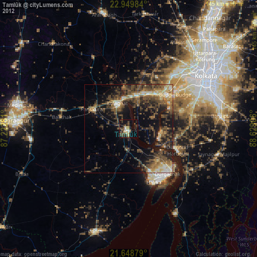
Tamlūk night lights from space
Night Light of Tamlūk (West Bengal) from space (India) Src. Average luminocity for 10x10km area is 53.2405% and for 50x50km: 45.7923%.
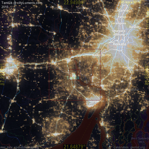
Analysis of Tamlūk night lights 2016
Square area 10x10 km:
 1.52%
1.52%90-99
11.74%80-89
6.44%70-79
7.95%60-69
10.23%50-59
13.26%40-49
13.26%30-39
12.12%20-29
22.35%10-19
1.14%0-9
0%Square area 50x50 km:
1.69%90-99
6.92%80-89
3.84%70-79
4.24%60-69
8.82%50-59
14.18%40-49
17.04%30-39
15.88%20-29
13.03%10-19
8.98%0-9
5.36%Clear (daylight) street map image can be seen on geolist.org.
Map coordinates:
22° 56' 59.4" North, 87° 13' 22.1" East
22° 18' 3" North, 87° 55' 33.3" East
21° 38' 55.6" North, 88° 37' 44.6" East
Some cities around Tamlūk sort by population:
• Baj Baj
32.3 km =20.1 mi,  53°
53°
• Pujali
29.4 km =18.3 mi, 49°
• Diamond Harbour
29.2 km =18.1 mi,  114°
114°
• Monoharpur
26.6 km =16.5 mi,  143°
143°
• Mahīshādal
13.9 km =8.6 mi,  156°
156°
• Jāfarpur
31.4 km =19.5 mi,  86°
86°
• Solap
30.7 km =19.1 mi,  128°
128°
• Bāwāli
30.8 km =19.1 mi,  63°
63°
1255046 (p: 48,646)
Sources (retrieved 2019-11-25):
» Earth at Night: Flat Maps 2012, 2016