Baj Baj night lights from space
Night Light of Baj Baj (West Bengal) from space (India) Src. Average luminocity for 10x10km area is 89.392% and for 50x50km: 69.0344%.
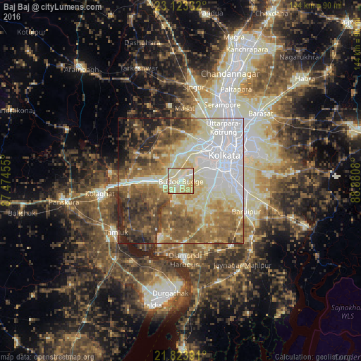
Analysis of Baj Baj night lights 2016
Square area 10x10 km:
 9.66%
9.66%90-99
52.08%80-89
25.38%70-79
8.52%60-69
4.36%50-59
0%40-49
0%30-39
0%20-29
0%10-19
0%0-9
0%Square area 50x50 km:
16.85%90-99
17.47%80-89
9.74%70-79
7.65%60-69
10.68%50-59
12.14%40-49
8.8%30-39
6.61%20-29
6.22%10-19
3.02%0-9
0.83%Clear (daylight) street map image can be seen on geolist.org.
Map coordinates:
23° 7' 24" North, 87° 28' 28.4" East
22° 28' 30.5" North, 88° 10' 39.6" East
21° 49' 26.1" North, 88° 52' 50.9" East
Some cities around Baj Baj sort by population:
• Nangi
5.3 km =3.3 mi,  46°
46°
• Pujali
3.4 km =2.1 mi,  262°
262°
• Sānkrāil
9.6 km =6 mi,  30°
30°
• Pānchla
8 km =5 mi,  329°
329°
• Fort Gloster
3.3 km =2.1 mi,  10°
10°
• Raghudebbati
5.9 km =3.7 mi,  18°
18°
• Bāwāli
5.7 km =3.5 mi,  163°
163°
• Sāhāpur
5.6 km =3.5 mi,  348°
348°
1277723 (p: 76,159)
Sources (retrieved 2019-11-25):
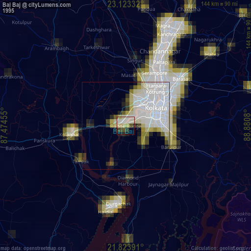
» NASA, Earths city lights 1995
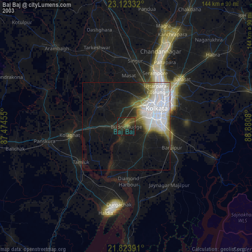
» NASA city lights 2003
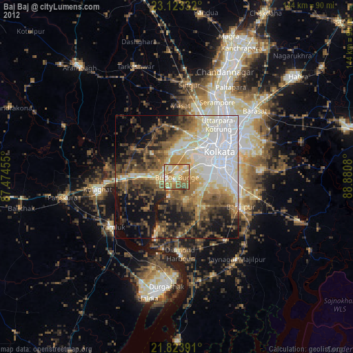
» Earth at Night: Flat Maps 2012, 2016