Jāfarpur night lights from space
Night Light of Jāfarpur (West Bengal) from space (India) Src. Average luminocity for 10x10km area is 65.2727% and for 50x50km: 65.8716%.
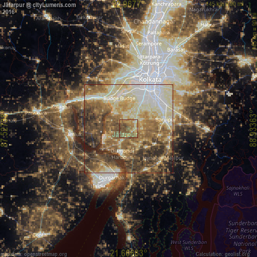
Analysis of Jāfarpur night lights 2016
Square area 10x10 km:
 1.33%
1.33%90-99
6.63%80-89
11.93%70-79
16.1%60-69
19.51%50-59
33.71%40-49
8.33%30-39
2.46%20-29
0%10-19
0%0-9
0%Square area 50x50 km:
8.88%90-99
15.96%80-89
11.38%70-79
8.54%60-69
12.22%50-59
14.66%40-49
11.17%30-39
9.5%20-29
6.27%10-19
1.43%0-9
0%Clear (daylight) street map image can be seen on geolist.org.
Map coordinates:
22° 58' 3.7" North, 87° 31' 38.6" East
22° 19' 7.6" North, 88° 13' 49.8" East
21° 40' 0.6" North, 88° 56' 1.1" East
Some cities around Jāfarpur sort by population:
• Nangi
21.1 km =13.1 mi,  355°
355°
• Baj Baj
18.2 km =11.3 mi,  342°
342°
• Pujali
19.1 km =11.9 mi,  332°
332°
• Diamond Harbour
14.8 km =9.2 mi,  198°
198°
• Fort Gloster
21.2 km =13.2 mi,  346°
346°
• Bāwāli
12.5 km =7.8 mi, 342°
• Amtala
7.6 km =4.7 mi,  40°
40°
• Serpur
8 km =5 mi,  86°
86°
1348944 (p: 14,798)
Sources (retrieved 2019-11-25):
» Earth at Night: Flat Maps 2012, 2016