Diamond Harbour night lights from space
Night Light of Diamond Harbour (West Bengal) from space (India) Src. Average luminocity for 10x10km area is 56.7027% and for 50x50km: 51.1047%.
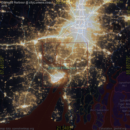
Analysis of Diamond Harbour night lights 2016
Square area 10x10 km:
 2.46%
2.46%90-99
8.14%80-89
7.39%70-79
9.85%60-69
14.02%50-59
19.51%40-49
10.8%30-39
11.36%20-29
16.48%10-19
0%0-9
0%Square area 50x50 km:
2.25%90-99
7.41%80-89
6.82%70-79
6.88%60-69
11.06%50-59
15.16%40-49
14.68%30-39
14.25%20-29
12.2%10-19
6.74%0-9
2.56%Clear (daylight) street map image can be seen on geolist.org.
Map coordinates:
22° 50' 33.1" North, 87° 28' 53.5" East
22° 11' 34.9" North, 88° 11' 4.8" East
21° 32' 25.8" North, 88° 53' 16" East
Some cities around Diamond Harbour sort by population:
• Haldia
16.6 km =10.3 mi,  207°
207°
• Monoharpur
14.4 km =8.9 mi,  229°
229°
• Mahīshādal
21 km =13 mi,  267°
267°
• Jāfarpur
14.8 km =9.2 mi,  18°
18°
• Solap
7.7 km =4.8 mi,  200°
200°
• Amtala
22 km =13.7 mi,  26°
26°
• Serpur
19.3 km =12 mi,  41°
41°
• Harindānga
22.2 km =13.8 mi,  140°
140°
1272657 (p: 40,095)
Sources (retrieved 2019-11-25):
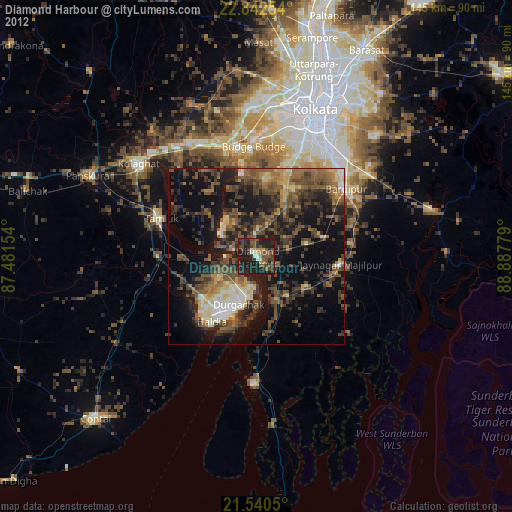
» Earth at Night: Flat Maps 2012, 2016