Sopur night lights from space
Night Light of Sopur (Jammu and Kashmir) from space (India) Src. Average luminocity for 10x10km area is 18.978% and for 50x50km: 7.8743%.
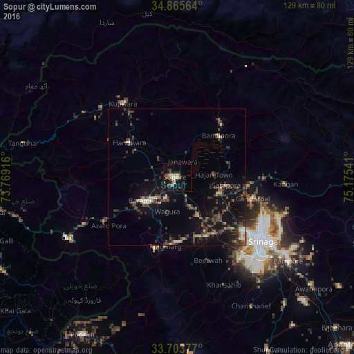
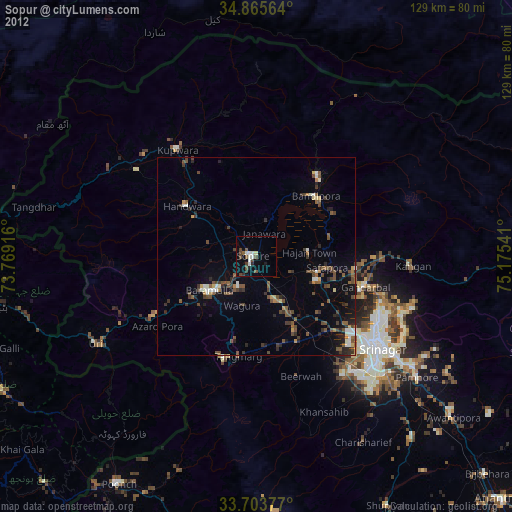
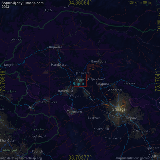
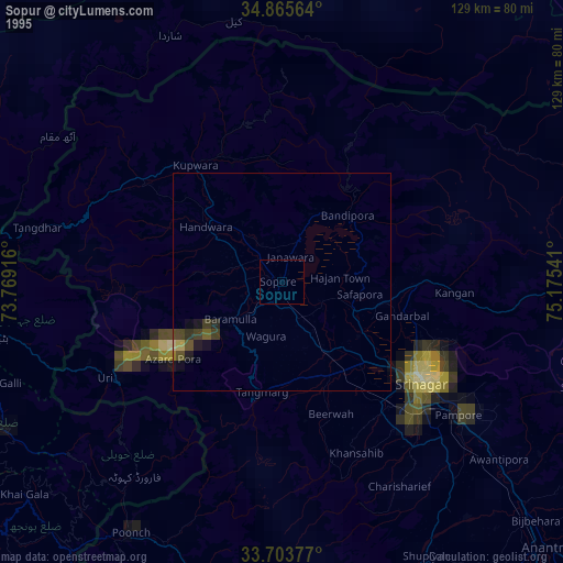
Analysis of Sopur night lights 2016
Square area 10x10 km:
 0.55%
0.55%90-99
3.85%80-89
2.93%70-79
0.37%60-69
2.93%50-59
2.75%40-49
4.03%30-39
3.11%20-29
3.11%10-19
19.78%0-9
56.59%Square area 50x50 km:
0.25%90-99
0.81%80-89
0.5%70-79
0.52%60-69
0.68%50-59
1.34%40-49
2.47%30-39
2.4%20-29
2.76%10-19
7.55%0-9
80.72%Clear (daylight) street map image can be seen on geolist.org.
Map coordinates:
34° 51' 56.3" North, 73° 46' 9" East
34° 17' 12.2" North, 74° 28' 20.2" East
33° 42' 13.6" North, 75° 10' 31.5" East
Some cities around Sopur sort by population:
• Soyībug
31.7 km =19.7 mi,  137°
137°
• Bāramūla
14.7 km =9.1 mi,  234°
234°
• Bandipura
21.4 km =13.3 mi,  47°
47°
• Gāndarbal
28.6 km =17.8 mi,  103°
103°
• Pattan
15.9 km =9.9 mi,  151°
151°
• Kupwāra
34.3 km =21.3 mi,  213°
213°
• Sumbal
17.2 km =10.7 mi,  111°
111°
• Hājan
13.3 km =8.3 mi,  84°
84°
1255714 (p: 63,035)
Sources (retrieved 2019-11-25):
» NASA, Earths city lights 1995
» NASA city lights 2003
» Earth at Night: Flat Maps 2012, 2016