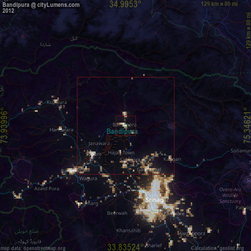
Bandipura night lights from space
Night Light of Bandipura (Jammu and Kashmir) from space (India) Src. Average luminocity for 10x10km area is 5.979% and for 50x50km: 4.1644%.
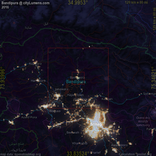
Analysis of Bandipura night lights 2016
Square area 10x10 km:
 0%
0%90-99
0.52%80-89
0.87%70-79
0%60-69
1.57%50-59
0.52%40-49
1.75%30-39
1.57%20-29
3.67%10-19
1.4%0-9
88.11%Square area 50x50 km:
0.1%90-99
0.27%80-89
0.31%70-79
0.29%60-69
0.44%50-59
0.86%40-49
1.33%30-39
1.06%20-29
1.68%10-19
3.91%0-9
89.75%Clear (daylight) street map image can be seen on geolist.org.
Map coordinates:
34° 59' 43.1" North, 73° 56' 23.9" East
34° 25' 2.2" North, 74° 38' 35.1" East
33° 50' 6.9" North, 75° 20' 46.4" East
Some cities around Bandipura sort by population:
• Srinagar
39.8 km =24.7 mi,  157°
157°
• Soyībug
38.3 km =23.8 mi,  171°
171°
• Bāramūla
36 km =22.4 mi,  229°
229°
• Sopur
21.4 km =13.3 mi, 227°
• Gāndarbal
24.4 km =15.2 mi,  150°
150°
• Pattan
29.6 km =18.4 mi,  195°
195°
• Sumbal
20.7 km =12.9 mi,  178°
178°
• Hājan
13.4 km =8.3 mi,  190°
190°
1277358 (p: 31,978)
Sources (retrieved 2019-11-25):
» Earth at Night: Flat Maps 2012, 2016