Mandsaur night lights from space
Night Light of Mandsaur (Madhya Pradesh) from space (India) Src. Average luminocity for 10x10km area is 51.6705% and for 50x50km: 5.6948%.
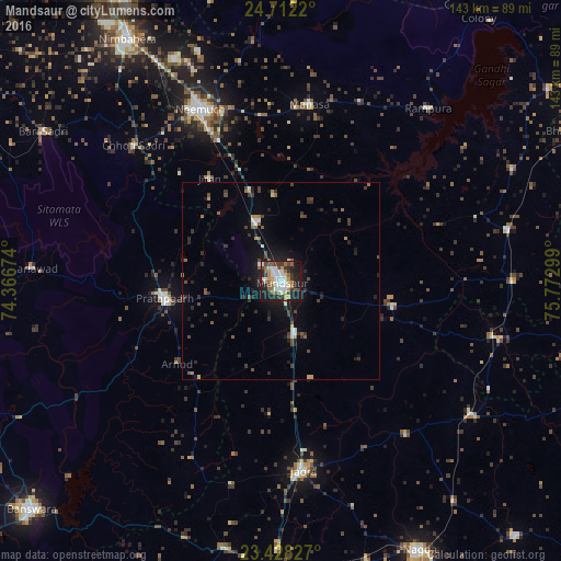


Analysis of Mandsaur night lights 2016
Square area 10x10 km:
 5.49%
5.49%90-99
18.37%80-89
3.41%70-79
6.44%60-69
6.06%50-59
8.9%40-49
6.06%30-39
8.9%20-29
11.74%10-19
23.3%0-9
1.33%Square area 50x50 km:
0.27%90-99
1.11%80-89
0.29%70-79
0.52%60-69
0.58%50-59
0.88%40-49
1.04%30-39
1.54%20-29
1.69%10-19
3.99%0-9
88.09%Clear (daylight) street map image can be seen on geolist.org.
Map coordinates:
24° 42' 43.9" North, 74° 22' 0.3" East
24° 4' 18.6" North, 75° 4' 11.5" East
23° 25' 41.8" North, 75° 46' 22.8" East
Some cities around Mandsaur sort by population:
• Jaorā
48.6 km =30.2 mi,  173°
173°
• Pratāpgarh
29.6 km =18.4 mi,  261°
261°
• Manāsa
45.7 km =28.4 mi,  9°
9°
• Tāl
50.6 km =31.4 mi,  140°
140°
• Sītāmau
29.5 km =18.3 mi,  102°
102°
• Jīran
32 km =19.9 mi,  325°
325°
• Nārāyangarh
22.2 km =13.8 mi,  354°
354°
• Malhārgarh
24.8 km =15.4 mi,  341°
341°
1263834 (p: 124,988)
Sources (retrieved 2019-11-25):
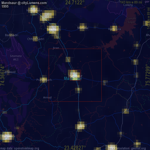
» NASA, Earths city lights 1995
» NASA city lights 2003
» Earth at Night: Flat Maps 2012, 2016