Singarāyakonda night lights from space
Night Light of Singarāyakonda (Andhra Pradesh) from space (India) Src. Average luminocity for 10x10km area is 22.3223% and for 50x50km: 6.4925%.
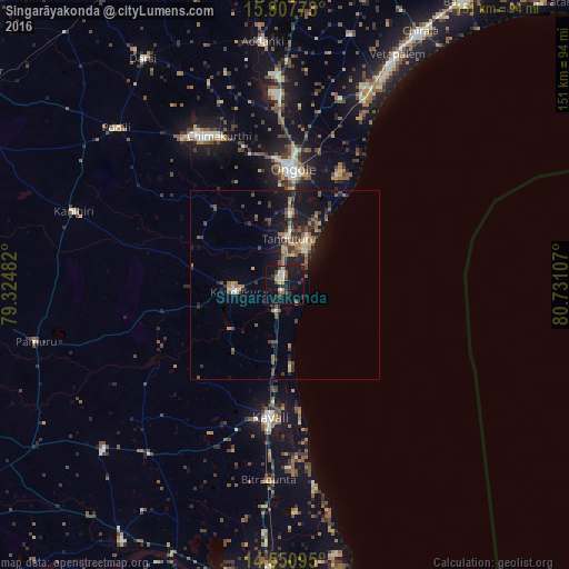
Analysis of Singarāyakonda night lights 2016
Square area 10x10 km:
 0.41%
0.41%90-99
2.69%80-89
2.27%70-79
3.1%60-69
2.48%50-59
3.72%40-49
3.72%30-39
6.2%20-29
4.13%10-19
34.09%0-9
37.19%Square area 50x50 km:
0.06%90-99
0.74%80-89
0.5%70-79
0.68%60-69
1.01%50-59
1.63%40-49
1.14%30-39
1.65%20-29
1.81%10-19
6.29%0-9
84.49%Clear (daylight) street map image can be seen on geolist.org.
Map coordinates:
15° 54' 28" North, 79° 19' 29.4" East
15° 13' 49.7" North, 80° 1' 40.6" East
14° 33' 3.4" North, 80° 43' 51.9" East
Some cities around Singarāyakonda sort by population:
• Ongole
30.4 km =18.9 mi,  3°
3°
• Kāvali
35.1 km =21.8 mi,  185°
185°
• Kandukūr
13.4 km =8.3 mi,  262°
262°
• Vetapālem
68.5 km =42.6 mi,  25°
25°
• Darsi
70.6 km =43.9 mi,  328°
328°
• Addanki
64.8 km =40.3 mi,  354°
354°
• Kanigiri
59.2 km =36.8 mi,  289°
289°
• Pavuluru
70.7 km =43.9 mi,  11°
11°
1256176 (p: 17,796)
Sources (retrieved 2019-11-25):
» Earth at Night: Flat Maps 2012, 2016