Dhemāji night lights from space
Night Light of Dhemāji (Assam) from space (India) Src. Average luminocity for 10x10km area is 2.2817% and for 50x50km: 0.8901%.
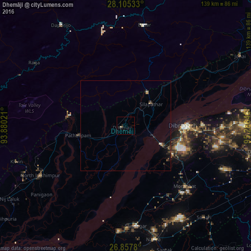
Analysis of Dhemāji night lights 2016
Square area 10x10 km:
 0%
0%90-99
0.6%80-89
0.2%70-79
0%60-69
0%50-59
0.6%40-49
0.2%30-39
0%20-29
1.98%10-19
2.38%0-9
94.05%Square area 50x50 km:
0.04%90-99
0.05%80-89
0.06%70-79
0.08%60-69
0.09%50-59
0.15%40-49
0.19%30-39
0.24%20-29
0.42%10-19
0.71%0-9
97.96%Clear (daylight) street map image can be seen on geolist.org.
Map coordinates:
28° 6' 19.2" North, 93° 52' 48.8" East
27° 28' 60" North, 94° 34' 60" East
26° 51' 28.1" North, 95° 17' 11.3" East
Some cities around Dhemāji sort by population:
• Dibrugarh
32.1 km =19.9 mi,  90°
90°
• Sibsāgar
55.8 km =34.7 mi,  174°
174°
• North Lakhimpur
54.8 km =34.1 mi,  239°
239°
• Silapathar
18.6 km =11.6 mi,  48°
48°
• Sonāri
66.6 km =41.4 mi,  140°
140°
• Nāzirā
64.8 km =40.3 mi, 166°
• Chābua
58.3 km =36.2 mi, 90°
• Morānha
46.5 km =28.9 mi, 135°
1272783 (p: 13,058)
Sources (retrieved 2019-11-25):
» Earth at Night: Flat Maps 2012, 2016