Shāhpur night lights from space
Night Light of Shāhpur (Bihar) from space (India) Src. Average luminocity for 10x10km area is 16.0417% and for 50x50km: 21.2245%.
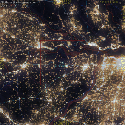
Analysis of Shāhpur night lights 2016
Square area 10x10 km:
 0.76%
0.76%90-99
1.52%80-89
0%70-79
1.52%60-69
2.84%50-59
2.84%40-49
3.98%30-39
1.7%20-29
9.85%10-19
13.64%0-9
61.36%Square area 50x50 km:
0.82%90-99
1.78%80-89
1.74%70-79
1.98%60-69
2.82%50-59
3.62%40-49
5.36%30-39
5.74%20-29
8.97%10-19
25.76%0-9
41.4%Clear (daylight) street map image can be seen on geolist.org.
Map coordinates:
26° 14' 7.2" North, 83° 42' 3.6" East
25° 36' 10.5" North, 84° 24' 14.8" East
24° 58' 1.8" North, 85° 6' 26.1" East
Some cities around Shāhpur sort by population:
• Arrah
26.5 km =16.5 mi,  101°
101°
• Dumraon
25.9 km =16.1 mi,  257°
257°
• Revelganj
31.2 km =19.4 mi,  48°
48°
• Jagdīspur
15.1 km =9.4 mi,  174°
174°
• Piro
30.1 km =18.7 mi,  179°
179°
• Reoti
27.7 km =17.2 mi,  354°
354°
• Bānsdīh
36.4 km =22.6 mi,  329°
329°
• Koāth
34 km =21.1 mi,  205°
205°
1256715 (p: 15,850)
Sources (retrieved 2019-11-25):
» Earth at Night: Flat Maps 2012, 2016