Samdari night lights from space
Night Light of Samdari (Rajasthan) from space (India) Src. Average luminocity for 10x10km area is 3.2405% and for 50x50km: 0.6263%.
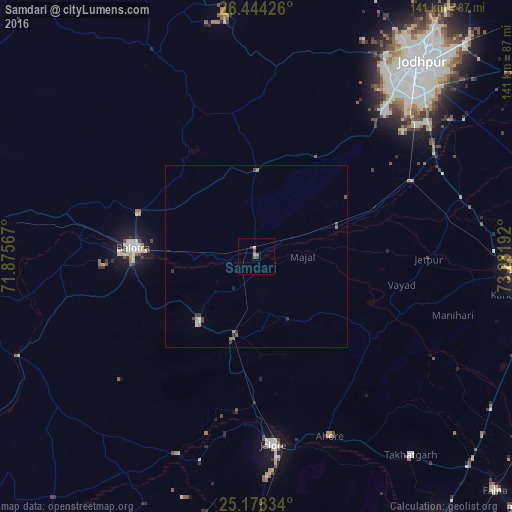
Analysis of Samdari night lights 2016
Square area 10x10 km:
 0%
0%90-99
0%80-89
0.76%70-79
0.76%60-69
0.38%50-59
1.14%40-49
0.76%30-39
0.95%20-29
0.57%10-19
0%0-9
94.7%Square area 50x50 km:
0%90-99
0.08%80-89
0.07%70-79
0.08%60-69
0.14%50-59
0.12%40-49
0.19%30-39
0.25%20-29
0.06%10-19
0.03%0-9
98.98%Clear (daylight) street map image can be seen on geolist.org.
Map coordinates:
26° 26' 39.3" North, 71° 52' 32.4" East
25° 48' 46.8" North, 72° 34' 43.6" East
25° 10' 42" North, 73° 16' 54.9" East
Some cities around Samdari sort by population:
• Jodhpur
66.2 km =41.1 mi,  40°
40°
• Pāli
74.7 km =46.4 mi,  93°
93°
• Bālotra
34 km =21.1 mi,  273°
273°
• Jalor
52.1 km =32.4 mi,  175°
175°
• Sheoganj
89.6 km =55.7 mi,  146°
146°
• Siwāna
23.8 km =14.8 mi,  221°
221°
• Takhatgarh
69.3 km =43.1 mi,  141°
141°
• Rāni
89.5 km =55.6 mi,  125°
125°
1257528 (p: 17,915)
Sources (retrieved 2019-11-25):
» Earth at Night: Flat Maps 2012, 2016