Renigunta night lights from space
Night Light of Renigunta (Andhra Pradesh) from space (India) Src. Average luminocity for 10x10km area is 59.7149% and for 50x50km: 16.8158%.
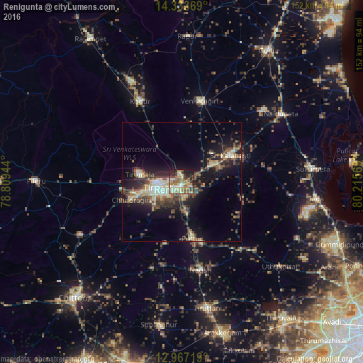
Analysis of Renigunta night lights 2016
Square area 10x10 km:
 0.41%
0.41%90-99
15.7%80-89
13.64%70-79
9.71%60-69
15.08%50-59
12.4%40-49
5.99%30-39
6.82%20-29
11.78%10-19
8.47%0-9
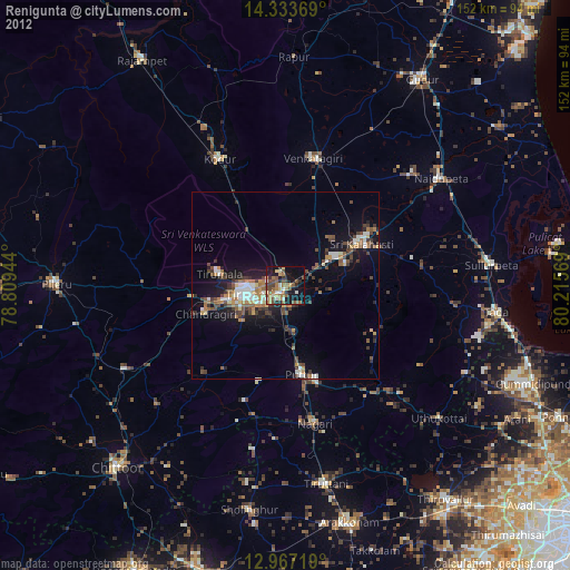
0%Square area 50x50 km:
0.6%90-99
3.19%80-89
2.68%70-79
1.68%60-69
2.03%50-59
3.27%40-49
3.51%30-39
3.72%20-29
4.77%10-19
10.85%0-9
63.71%Clear (daylight) street map image can be seen on geolist.org.
Map coordinates:
14° 20' 1.3" North, 78° 48' 34" East
13° 39' 5.1" North, 79° 30' 45.2" East
12° 58' 1.9" North, 80° 12' 56.5" East
Some cities around Renigunta sort by population:
• Tirupati
10.2 km =6.3 mi,  259°
259°
• Venkatagiri
35.1 km =21.8 mi,  12°
12°
• Puttūr
23.7 km =14.7 mi,  169°
169°
• Akkarampalle
10 km =6.2 mi,  269°
269°
• Tirumala
17.9 km =11.1 mi,  281°
281°
• Nārāyanavanam
26.4 km =16.4 mi,  161°
161°
• Narasingāpuram
21.7 km =13.5 mi, 257°
• Pallipattu
35.5 km =22.1 mi,  191°
191°
1258213 (p: 25,895)
Sources (retrieved 2019-11-25):
» Earth at Night: Flat Maps 2012, 2016