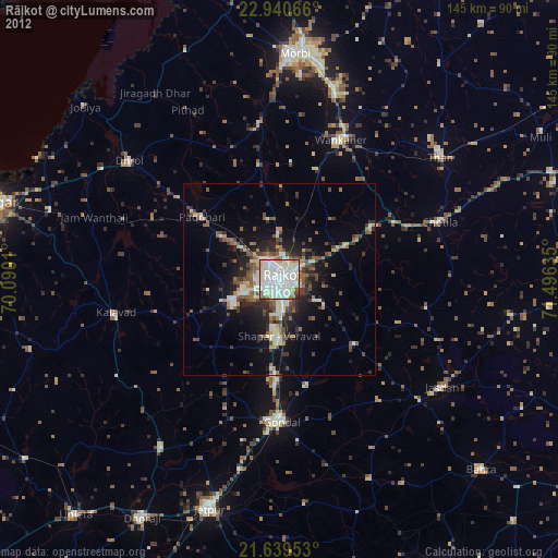
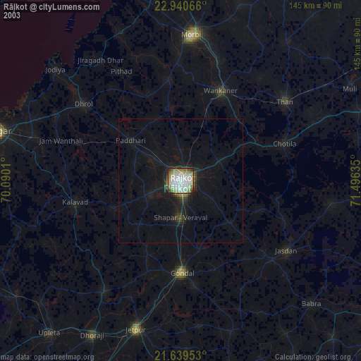
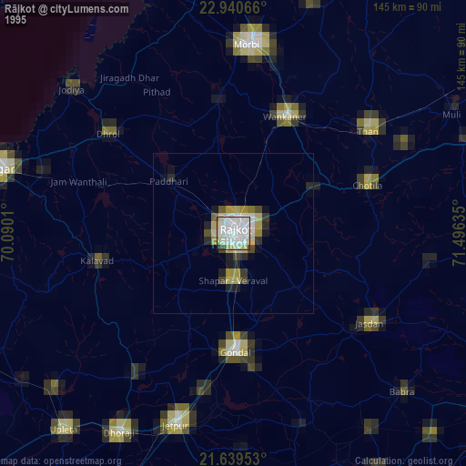
Rājkot night lights from space
Night Light of Rājkot (Gujarat) from space (India) Src. Average luminocity for 10x10km area is 95.678% and for 50x50km: 19.5726%.
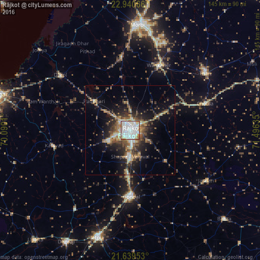
Analysis of Rājkot night lights 2016
Square area 10x10 km:
 52.08%
90-99
34.66%80-89
5.68%70-79
2.27%60-69
4.36%50-59
0.95%40-49
0%30-39
0%20-29
0%10-19
0%0-9
0%Square area 50x50 km:
2.67%90-99
3.3%80-89
1.95%70-79
2.14%60-69
2.78%50-59
3.11%40-49
3.44%30-39
3.65%20-29
5.51%10-19
10.63%0-9
60.84%Clear (daylight) street map image can be seen on geolist.org.
Map coordinates:
22° 56' 26.4" North, 70° 5' 24.4" East
22° 17' 29.8" North, 70° 47' 35.6" East
21° 38' 22.3" North, 71° 29' 46.9" East
Some cities around Rājkot sort by population:
• Gondal
36.8 km =22.9 mi,  178°
178°
• Wānkāner
38.8 km =24.1 mi,  23°
23°
• Dhrol
49.3 km =30.6 mi,  308°
308°
• Kālāvad
43.2 km =26.8 mi,  257°
257°
• Chotila
44 km =27.3 mi,  70°
70°
• Shāhpur
15.2 km =9.4 mi,  188°
188°
• Tankāra
40.8 km =25.4 mi,  353°
353°
• Paddhari
25.5 km =15.8 mi, 309°
1258847 (p: 1,177,362)
Sources (retrieved 2019-11-25):
» NASA, Earths city lights 1995
» NASA city lights 2003
» Earth at Night: Flat Maps 2012, 2016