Gondal night lights from space
Night Light of Gondal (Gujarat) from space (India) Src. Average luminocity for 10x10km area is 41.8948% and for 50x50km: 10.0936%.
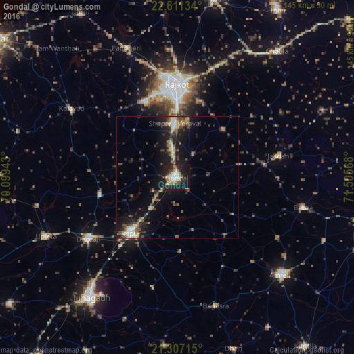
Analysis of Gondal night lights 2016
Square area 10x10 km:
 5.75%
5.75%90-99
9.92%80-89
6.55%70-79
5.16%60-69
3.57%50-59
5.16%40-49
3.57%30-39
6.94%20-29
11.31%10-19
33.53%0-9
8.53%Square area 50x50 km:
0.6%90-99
1.53%80-89
1.01%70-79
1.16%60-69
1.2%50-59
1.65%40-49
1.93%30-39
1.86%20-29
2.92%10-19
9.85%0-9
76.3%Clear (daylight) street map image can be seen on geolist.org.
Map coordinates:
22° 36' 40.8" North, 70° 5' 57.9" East
21° 57' 38.7" North, 70° 48' 9.2" East
21° 18' 25.7" North, 71° 30' 20.4" East
Some cities around Gondal sort by population:
• Rājkot
36.8 km =22.9 mi,  358°
358°
• Jetpur
29.4 km =18.3 mi,  218°
218°
• Dhorāji
44.3 km =27.5 mi,  235°
235°
• Jasdan
42.6 km =26.5 mi,  78°
78°
• Kālāvad
51.2 km =31.8 mi,  302°
302°
• Bābra
53.4 km =33.2 mi,  103°
103°
• Jetalsar
36.4 km =22.6 mi, 219°
• Shāhpur
22 km =13.7 mi,  351°
351°
1270994 (p: 101,801)
Sources (retrieved 2019-11-25):
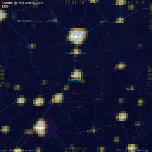
» NASA, Earths city lights 1995
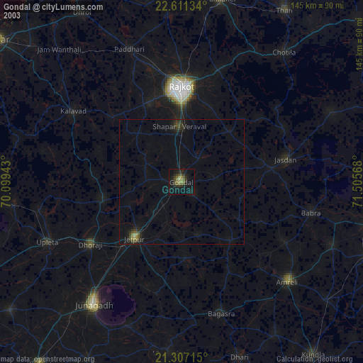
» NASA city lights 2003
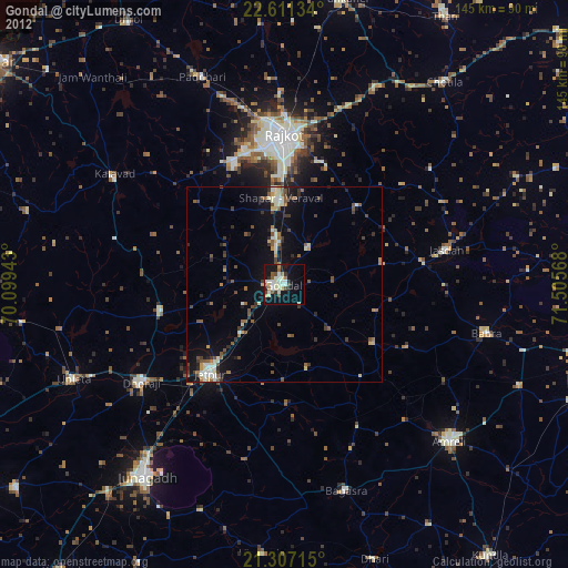
» Earth at Night: Flat Maps 2012, 2016