Kālāvad night lights from space
Night Light of Kālāvad (Gujarat) from space (India) Src. Average luminocity for 10x10km area is 7.6174% and for 50x50km: 2.5019%.
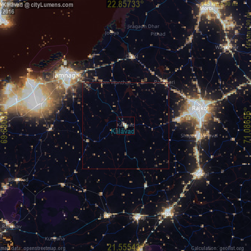
Analysis of Kālāvad night lights 2016
Square area 10x10 km:
 0%
0%90-99
1.52%80-89
0.76%70-79
0.76%60-69
0.76%50-59
1.7%40-49
2.84%30-39
1.89%20-29
0.38%10-19
0.38%0-9
89.02%Square area 50x50 km:
0%90-99
0.13%80-89
0.14%70-79
0.19%60-69
0.34%50-59
0.47%40-49
0.83%30-39
0.96%20-29
1.25%10-19
0.81%0-9
94.88%Clear (daylight) street map image can be seen on geolist.org.
Map coordinates:
22° 51' 26.4" North, 69° 40' 49.1" East
22° 12' 28.4" North, 70° 23' 0.3" East
21° 33' 19.5" North, 71° 5' 11.6" East
Some cities around Kālāvad sort by population:
• Rājkot
43.2 km =26.8 mi,  77°
77°
• Jamnagar
43.9 km =27.3 mi,  312°
312°
• Dhrol
40.1 km =24.9 mi,  5°
5°
• Bedi
47.8 km =29.7 mi, 313°
• Bhāyāvadar
41.6 km =25.8 mi,  199°
199°
• Lālpur
43.3 km =26.9 mi,  267°
267°
• Shāhpur
40.3 km =25 mi,  98°
98°
• Paddhari
33.9 km =21.1 mi,  41°
41°
1268450 (p: 26,287)
Sources (retrieved 2019-11-25):
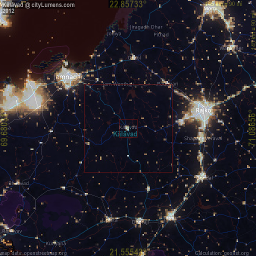
» Earth at Night: Flat Maps 2012, 2016