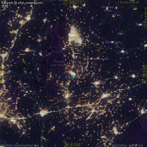
Rājgarh night lights from space
Night Light of Rājgarh (Rajasthan) from space (India) Src. Average luminocity for 10x10km area is 39.0511% and for 50x50km: 17.3844%.
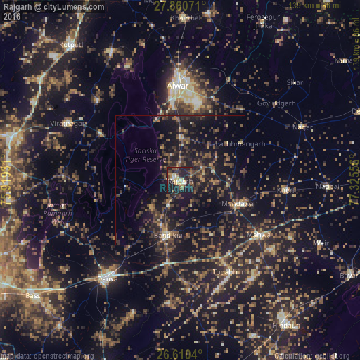
Analysis of Rājgarh night lights 2016
Square area 10x10 km:
 1.89%
1.89%90-99
5.11%80-89
8.52%70-79
3.6%60-69
3.03%50-59
6.25%40-49
8.52%30-39
8.14%20-29
26.52%10-19
28.22%0-9
0.19%Square area 50x50 km:
0.27%90-99
0.87%80-89
1.4%70-79
1.14%60-69
2.34%50-59
3.91%40-49
4.64%30-39
5.9%20-29
8.16%10-19
23.57%0-9
47.81%Clear (daylight) street map image can be seen on geolist.org.
Map coordinates:
27° 51' 38.6" North, 75° 55' 9.5" East
27° 14' 14.3" North, 76° 37' 20.7" East
26° 36' 37.4" North, 77° 19' 32" East
Some cities around Rājgarh sort by population:
• Alwar
36.2 km =22.5 mi,  0°
0°
• Dausa
47.9 km =29.8 mi,  216°
216°
• Mahwah
37.3 km =23.2 mi,  124°
124°
• Todabhim
40.5 km =25.2 mi,  151°
151°
• Baswa
10.5 km =6.5 mi,  201°
201°
• Bhasāwar
47.6 km =29.6 mi, 117°
• Bāndīkūi
21.3 km =13.2 mi,  193°
193°
• Govindgarh
47.6 km =29.6 mi,  51°
51°
1258869 (p: 26,953)
Sources (retrieved 2019-11-25):
» Earth at Night: Flat Maps 2012, 2016