Rāhatgarh night lights from space
Night Light of Rāhatgarh (Madhya Pradesh) from space (India) Src. Average luminocity for 10x10km area is 7.2183% and for 50x50km: 4.8272%.
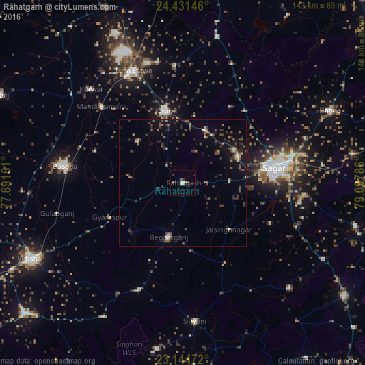
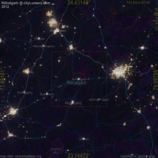
Analysis of Rāhatgarh night lights 2016
Square area 10x10 km:
 1.19%
1.19%90-99
0.99%80-89
0.99%70-79
0%60-69
1.59%50-59
1.39%40-49
0.2%30-39
0.4%20-29
2.78%10-19
1.98%0-9
88.49%Square area 50x50 km:
0.22%90-99
0.29%80-89
0.44%70-79
0.21%60-69
0.63%50-59
1.16%40-49
1.13%30-39
1.31%20-29
1.57%10-19
3.02%0-9
90.01%Clear (daylight) street map image can be seen on geolist.org.
Map coordinates:
24° 25' 53.3" North, 77° 41' 29.8" East
23° 47' 22.8" North, 78° 23' 41" East
23° 8' 41" North, 79° 5' 52.3" East
Some cities around Rāhatgarh sort by population:
• Saugor
35.4 km =22 mi,  81°
81°
• Bāsoda
47.1 km =29.3 mi,  278°
278°
• Etāwa
47.9 km =29.8 mi,  336°
336°
• Begamganj
21.9 km =13.6 mi,  194°
194°
• Khurai
29 km =18 mi,  346°
346°
• Dhāna
47.8 km =29.7 mi,  95°
95°
• Karrāpur
51.1 km =31.8 mi,  69°
69°
• Bamora
42.9 km =26.7 mi,  313°
313°
1259034 (p: 27,462)
Sources (retrieved 2019-11-25):
» Earth at Night: Flat Maps 2012, 2016