Powai night lights from space
Night Light of Powai (Maharashtra) from space (India) Src. Average luminocity for 10x10km area is 97.0996% and for 50x50km: 63.6252%.
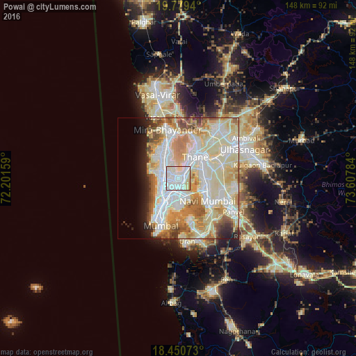
Analysis of Powai night lights 2016
Square area 10x10 km:
 55.84%
90-99
32.25%80-89
11.04%70-79
0.87%60-69
0%50-59
0%40-49
0%30-39
0%20-29
0%10-19
0%0-9
0%Square area 50x50 km:
17.08%90-99
20.4%80-89
13.17%70-79
6.82%60-69
7.39%50-59
4.18%40-49
3.12%30-39
1.83%20-29
3.29%10-19
3.93%0-9
18.8%Clear (daylight) street map image can be seen on geolist.org.
Map coordinates:
19° 46' 45.8" North, 72° 12' 5.7" East
19° 6' 59" North, 72° 54' 17" East
18° 27' 2.6" North, 73° 36' 28.2" East
Some cities around Powai sort by population:
• Mumbai
5.4 km =3.4 mi,  205°
205°
• Navi Mumbai
14.7 km =9.1 mi,  127°
127°
• Thāne
10.9 km =6.8 mi,  34°
34°
• Dombivli
21.8 km =13.5 mi,  59°
59°
• Borivli
14 km =8.7 mi,  340°
340°
• Bhayandar
21.3 km =13.2 mi, 344°
• Airoli
10.4 km =6.5 mi,  68°
68°
• Artist Village
17.3 km =10.7 mi,  122°
122°
6324621 (p: 20,000)
Sources (retrieved 2019-11-25):
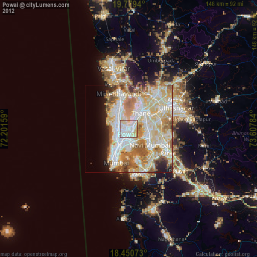
» Earth at Night: Flat Maps 2012, 2016