Bhayandar night lights from space
Night Light of Bhayandar (Maharashtra) from space (India) Src. Average luminocity for 10x10km area is 76.1602% and for 50x50km: 46.9189%.
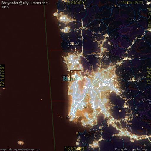
Analysis of Bhayandar night lights 2016
Square area 10x10 km:
 16.23%
90-99
18.83%80-89
14.94%70-79
6.93%60-69
15.15%50-59
16.67%40-49
8.66%30-39
2.6%20-29
0%10-19
0%0-9
0%Square area 50x50 km:
11.26%90-99
14.08%80-89
9.89%70-79
5.05%60-69
4.59%50-59
3.49%40-49
2.94%30-39
2.42%20-29
5.75%10-19
7.99%0-9
32.55%Clear (daylight) street map image can be seen on geolist.org.
Map coordinates:
19° 57' 49.7" North, 72° 8' 52.6" East
19° 18' 5.7" North, 72° 51' 3.9" East
18° 38' 11.9" North, 73° 33' 15.1" East
Some cities around Bhayandar sort by population:
• Mumbai
25.6 km =15.9 mi,  172°
172°
• Thāne
16.6 km =10.3 mi,  134°
134°
• Dombivli
26.1 km =16.2 mi,  111°
111°
• Bhiwandi
21.8 km =13.5 mi,  90°
90°
• Borivli
7.5 km =4.7 mi, 172°
• Virār
17.7 km =11 mi,  346°
346°
• Airoli
22.6 km =14 mi,  137°
137°
• Powai
21.3 km =13.2 mi,  164°
164°
1276014 (p: 520,301)
Sources (retrieved 2019-11-25):
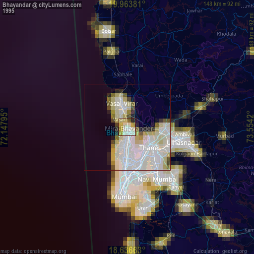
» NASA, Earths city lights 1995
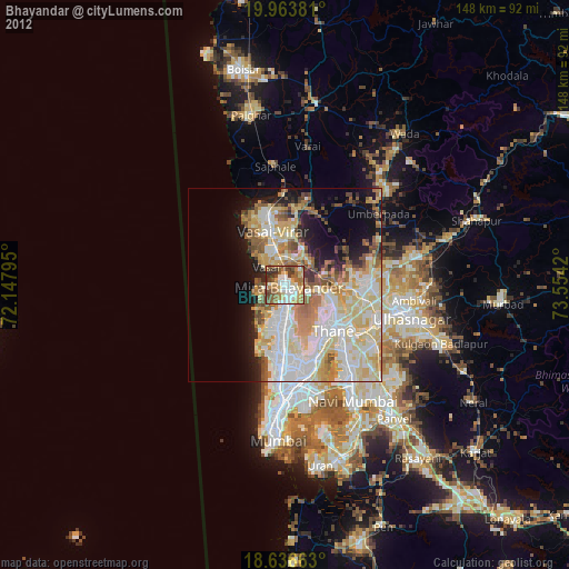
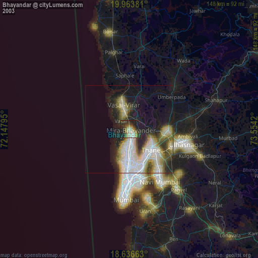
» NASA city lights 2003
» Earth at Night: Flat Maps 2012, 2016