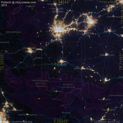
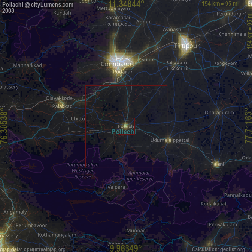
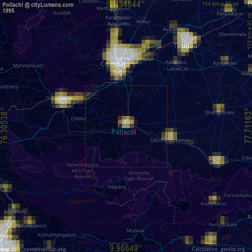
Pollachi night lights from space
Night Light of Pollachi (Tamil Nadu) from space (India) Src. Average luminocity for 10x10km area is 40.3905% and for 50x50km: 6.6142%.

Analysis of Pollachi night lights 2016
Square area 10x10 km:
 1.24%
1.24%90-99
2.27%80-89
7.64%70-79
10.54%60-69
6.82%50-59
4.75%40-49
9.5%30-39
11.57%20-29
11.57%10-19
31.82%0-9
2.27%Square area 50x50 km:
0.05%90-99
0.1%80-89
0.68%70-79
1.08%60-69
0.91%50-59
0.8%40-49
1.99%30-39
1.67%20-29
2.73%10-19
6.36%0-9
83.64%Clear (daylight) street map image can be seen on geolist.org.
Map coordinates:
11° 20' 54.4" North, 76° 18' 19.4" East
10° 39' 29.7" North, 77° 0' 30.6" East
9° 57' 59.4" North, 77° 42' 41.9" East
Some cities around Pollachi sort by population:
• Udumalaippettai
27.3 km =17 mi,  106°
106°
• Chittūr
28.9 km =18 mi,  279°
279°
• Madukkarai
27.9 km =17.3 mi,  349°
349°
• Chettipālaiyam
28.4 km =17.6 mi,  6°
6°
• Vettaikkaranpudur
14.9 km =9.3 mi,  224°
224°
• Anamalais
11.6 km =7.2 mi, 224°
• Periyanegamam
14 km =8.7 mi,  47°
47°
• Dhali
25.6 km =15.9 mi,  129°
129°
1259440 (p: 88,214)
Sources (retrieved 2019-11-25):
» NASA, Earths city lights 1995
» NASA city lights 2003
» Earth at Night: Flat Maps 2012, 2016