Nagda night lights from space
Night Light of Nagda (Madhya Pradesh) from space (India) Src. Average luminocity for 10x10km area is 36.0473% and for 50x50km: 4.6074%.
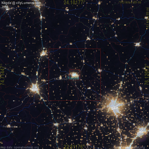
Analysis of Nagda night lights 2016
Square area 10x10 km:
 3.6%
3.6%90-99
7.2%80-89
5.11%70-79
3.79%60-69
5.87%50-59
3.41%40-49
5.11%30-39
5.87%20-29
8.14%10-19
42.61%0-9
9.28%Square area 50x50 km:
0.22%90-99
0.46%80-89
0.45%70-79
0.26%60-69
0.45%50-59
0.65%40-49
0.97%30-39
1.51%20-29
1.93%10-19
3.12%0-9
89.98%Clear (daylight) street map image can be seen on geolist.org.
Map coordinates:
24° 6' 6.4" North, 74° 42' 52.1" East
23° 27' 30" North, 75° 25' 3.3" East
22° 48' 42.3" North, 76° 7' 14.6" East
Some cities around Nagda sort by population:
• Jaorā
35.7 km =22.2 mi,  303°
303°
• Khāchrod
14.4 km =8.9 mi,  254°
254°
• Alot
36.8 km =22.9 mi,  22°
22°
• Unhel
19.7 km =12.2 mi,  132°
132°
• Tāl
29.3 km =18.2 mi,  353°
353°
• Namli
36.4 km =22.6 mi,  270°
270°
• Piploda
12.2 km =7.6 mi,  172°
172°
• Gogāpur
14.9 km =9.3 mi,  42°
42°
1262209 (p: 103,501)
Sources (retrieved 2019-11-25):
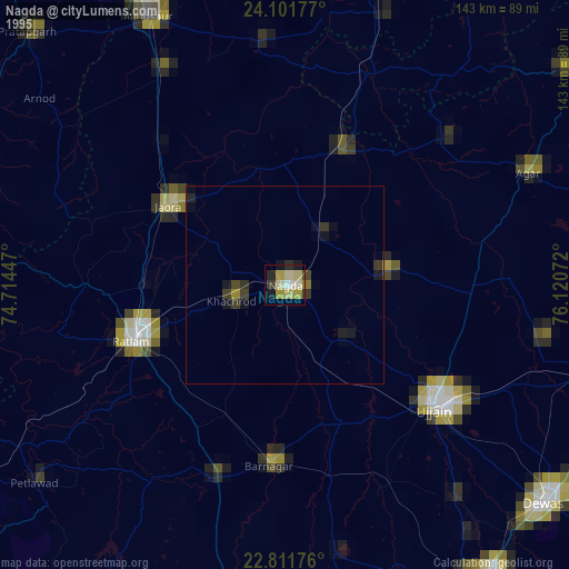
» NASA, Earths city lights 1995
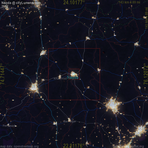
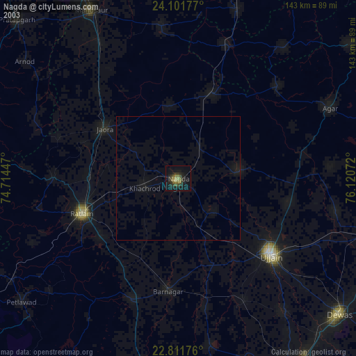
» NASA city lights 2003
» Earth at Night: Flat Maps 2012, 2016