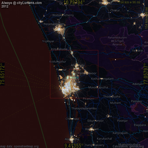
Alwaye night lights from space
Night Light of Alwaye (Kerala) from space (India) Src. Average luminocity for 10x10km area is 65.4711% and for 50x50km: 21.9294%.

Analysis of Alwaye night lights 2016
Square area 10x10 km:
 1.24%
1.24%90-99
9.71%80-89
11.36%70-79
22.52%60-69
19.01%50-59
18.6%40-49
10.33%30-39
3.1%20-29
3.51%10-19
0.62%0-9
0%Square area 50x50 km:
2.38%90-99
3.89%80-89
3.03%70-79
4.3%60-69
3.26%50-59
3.22%40-49
4.02%30-39
3.88%20-29
4.31%10-19
8.12%0-9
59.58%Clear (daylight) street map image can be seen on geolist.org.
Map coordinates:
10° 47' 52.6" North, 75° 39' 6.2" East
10° 6' 23.4" North, 76° 21' 17.4" East
9° 24' 48.8" North, 77° 3' 28.7" East
Some cities around Alwaye sort by population:
• Cochin
21.2 km =13.2 mi,  209°
209°
• Kalamassery
5.9 km =3.7 mi, 211°
• Kizhake Chālakudi
21.7 km =13.5 mi,  355°
355°
• Angamāli
10 km =6.2 mi,  21°
21°
• Elūr
9 km =5.6 mi,  240°
240°
• Perumpāvūr
13.3 km =8.3 mi,  85°
85°
• Perumbavoor
13 km =8.1 mi, 89°
• Aluva
0.4 km =0.2 mi,  289°
289°
1278941 (p: 23,703)
Sources (retrieved 2019-11-25):
» Earth at Night: Flat Maps 2012, 2016