Parnera night lights from space
Night Light of Parnera (Gujarat) from space (India) Src. Average luminocity for 10x10km area is 44.5871% and for 50x50km: 16.0888%.
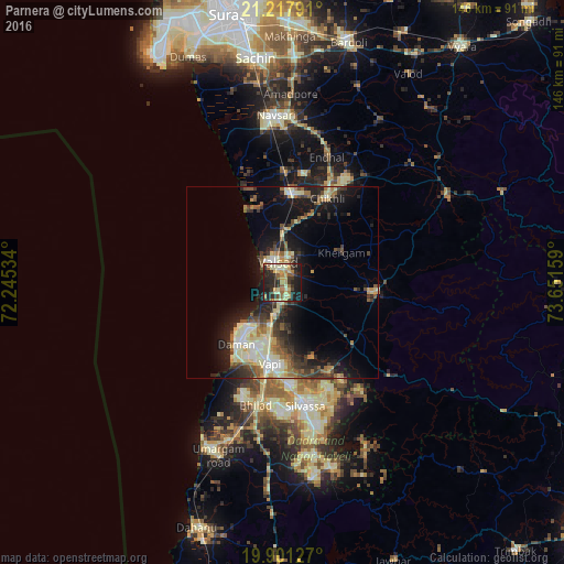
Analysis of Parnera night lights 2016
Square area 10x10 km:
 0%
0%90-99
10.04%80-89
9.47%70-79
7.95%60-69
6.44%50-59
6.44%40-49
2.08%30-39
11.17%20-29
20.83%10-19
24.81%0-9
0.76%Square area 50x50 km:
0.99%90-99
3.74%80-89
2.48%70-79
1.51%60-69
2.16%50-59
2.32%40-49
2.15%30-39
3.3%20-29
5.06%10-19
10.4%0-9
65.89%Clear (daylight) street map image can be seen on geolist.org.
Map coordinates:
21° 13' 4.5" North, 72° 14' 43.2" East
20° 33' 39.6" North, 72° 56' 54.5" East
19° 54' 4.6" North, 73° 39' 5.7" East
Some cities around Parnera sort by population:
• Bilimora
23.2 km =14.4 mi,  3°
3°
• Valsād
5.7 km =3.5 mi,  344°
344°
• Vapi
21.5 km =13.4 mi,  192°
192°
• Daman
20.3 km =12.6 mi,  216°
216°
• Pārdi
5.8 km =3.6 mi,  182°
182°
• Dharampur
23.6 km =14.7 mi,  96°
96°
• Gandevi
28.4 km =17.6 mi,  10°
10°
• Chikhli
24.9 km =15.5 mi,  28°
28°
1260281 (p: 11,434)
Sources (retrieved 2019-11-25):
» Earth at Night: Flat Maps 2012, 2016