Pārdi night lights from space
Night Light of Pārdi (Gujarat) from space (India) Src. Average luminocity for 10x10km area is 36.8674% and for 50x50km: 19.1856%.
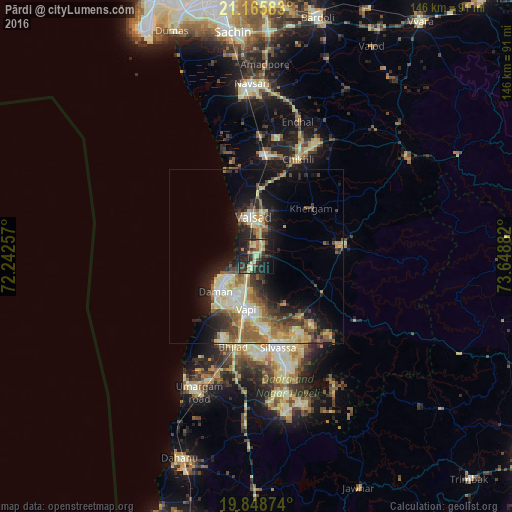
Analysis of Pārdi night lights 2016
Square area 10x10 km:
100  0.19%
0.19%
90-99 6.06%
80-89 8.14%
70-79 3.79%
60-69 5.11%
50-59 3.22%
40-49 4.73%
30-39 13.07%
20-29 20.83%
10-19 29.55%
0-9 5.3%
0.19%90-99
6.06%80-89
8.14%70-79
3.79%60-69
5.11%50-59
3.22%40-49
4.73%30-39
13.07%20-29
20.83%10-19
29.55%0-9
5.3%Square area 50x50 km:
100 1.17%
90-99 4.35%
80-89 3.62%
70-79 2.08%
60-69 3.01%
50-59 3.09%
40-49 2.7%
30-39 3.34%
20-29 4.91%
10-19 9.3%
0-9 62.44%
1.17%90-99
4.35%80-89
3.62%70-79
2.08%60-69
3.01%50-59
3.09%40-49
2.7%30-39
3.34%20-29
4.91%10-19
9.3%0-9
62.44%Clear (daylight) street map image can be seen on geolist.org.
Map coordinates:
21° 9' 57" North, 72° 14' 33.3" East
20° 30' 31.3" North, 72° 56' 44.5" East
19° 50' 55.5" North, 73° 38' 55.8" East
Some cities around Pārdi sort by population:
• Bilimora
29.1 km =18.1 mi,  3°
3°
• Valsād
11.3 km =7 mi,  353°
353°
• Vapi
15.8 km =9.8 mi,  195°
195°
• Daman
15.8 km =9.8 mi,  228°
228°
• Āmli
26.1 km =16.2 mi,  163°
163°
• Silvassa
26.6 km =16.5 mi,  168°
168°
• Dharampur
23.9 km =14.9 mi,  82°
82°
• Parnera
5.8 km =3.6 mi, 2°
1260335 (p: 27,423)
Sources (retrieved 2019-11-25):
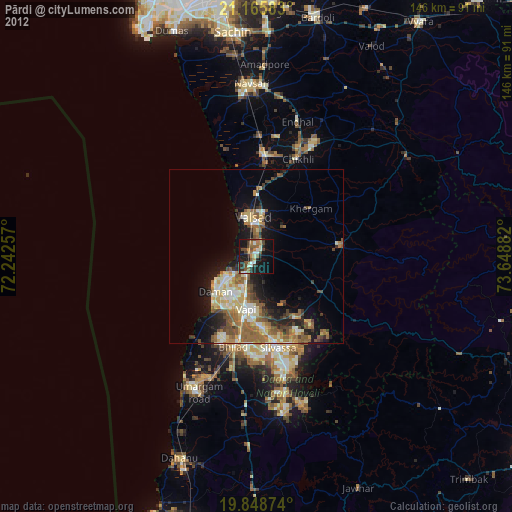
» Earth at Night: Flat Maps 2012, 2016