Pāli night lights from space
Night Light of Pāli (Uttar Pradesh) from space (India) Src. Average luminocity for 10x10km area is 2.4087% and for 50x50km: 4.2359%.
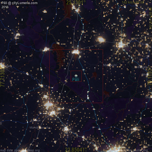
Analysis of Pāli night lights 2016
Square area 10x10 km:
 0.2%
0.2%90-99
0.6%80-89
0%70-79
0%60-69
0%50-59
0.79%40-49
1.59%30-39
0%20-29
0.79%10-19
0%0-9
96.03%Square area 50x50 km:
0.44%90-99
0.66%80-89
0.21%70-79
0.28%60-69
0.4%50-59
0.67%40-49
0.93%30-39
1.01%20-29
1.27%10-19
2.98%0-9
91.15%Clear (daylight) street map image can be seen on geolist.org.
Map coordinates:
25° 7' 48.4" North, 77° 42' 47" East
24° 29' 30.8" North, 78° 24' 58.2" East
23° 51' 1.5" North, 79° 7' 9.5" East
Some cities around Pāli sort by population:
• Lalitpur
22 km =13.7 mi,  0°
0°
• Tīkamgarh
50.4 km =31.3 mi,  56°
56°
• Etāwa
40.5 km =25.2 mi,  212°
212°
• Chanderi
37.4 km =23.2 mi,  311°
311°
• Khurai
50.6 km =31.4 mi,  189°
189°
• Bāmor Kalān
52 km =32.3 mi,  329°
329°
• Mungaoli
33.7 km =20.9 mi,  254°
254°
• Mahroni
33.2 km =20.6 mi,  71°
71°
1260717 (p: 9,098)
Sources (retrieved 2019-11-25):
» Earth at Night: Flat Maps 2012, 2016