Pahlgām night lights from space
Night Light of Pahlgām (Jammu and Kashmir) from space (India) Src. Average luminocity for 10x10km area is 3.7762% and for 50x50km: 0.5675%.
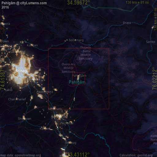
Analysis of Pahlgām night lights 2016
Square area 10x10 km:
 0%
0%90-99
0%80-89
0.7%70-79
0.7%60-69
0.17%50-59
1.22%40-49
0.7%30-39
1.4%20-29
2.8%10-19
0%0-9
92.31%Square area 50x50 km:
0.02%90-99
0.01%80-89
0.1%70-79
0.06%60-69
0.04%50-59
0.1%40-49
0.15%30-39
0.18%20-29
0.27%10-19
0.14%0-9
98.92%Clear (daylight) street map image can be seen on geolist.org.
Map coordinates:
34° 35' 48.2" North, 74° 36' 57.1" East
34° 0' 57.3" North, 75° 19' 8.4" East
33° 25' 52" North, 76° 1' 19.6" East
Some cities around Pahlgām sort by population:
• Srinagar
47.9 km =29.8 mi,  279°
279°
• Anantnag
35.2 km =21.9 mi,  205°
205°
• Bijbehara
31.5 km =19.6 mi,  218°
218°
• Pulwama
41.8 km =26 mi,  247°
247°
• Kulgam
49.7 km =30.9 mi, 213°
• Trāl
21.2 km =13.2 mi,  242°
242°
• Awantipur
30 km =18.6 mi, 249°
• Qāzigund
45 km =28 mi,  201°
201°
1260880 (p: 7,750)
Sources (retrieved 2019-11-25):
» Earth at Night: Flat Maps 2012, 2016