Nāgothana night lights from space
Night Light of Nāgothana (Maharashtra) from space (India) Src. Average luminocity for 10x10km area is 33.4835% and for 50x50km: 8.3363%.
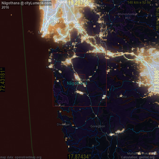
Analysis of Nāgothana night lights 2016
Square area 10x10 km:
 1.65%
1.65%90-99
6.82%80-89
9.09%70-79
1.65%60-69
4.13%50-59
8.68%40-49
1.45%30-39
4.34%20-29
3.1%10-19
37.6%0-9
21.49%Square area 50x50 km:
0.29%90-99
1.11%80-89
1.23%70-79
0.8%60-69
0.89%50-59
1.48%40-49
1.18%30-39
1.36%20-29
2.44%10-19
8.41%0-9
80.82%Clear (daylight) street map image can be seen on geolist.org.
Map coordinates:
19° 12' 27.2" North, 72° 25' 54.5" East
18° 32' 32.1" North, 73° 8' 5.7" East
17° 52' 27.6" North, 73° 50' 17" East
Some cities around Nāgothana sort by population:
• Roha
11.8 km =7.3 mi,  187°
187°
• Khopoli
35 km =21.7 mi,  39°
39°
• Lonavla
36.9 km =22.9 mi,  50°
50°
• Pen
22.1 km =13.7 mi,  349°
349°
• Indāpur
29.5 km =18.3 mi,  155°
155°
• Alībāg
29.7 km =18.5 mi,  293°
293°
• Murud
30 km =18.6 mi,  217°
217°
• Revadanda
22.1 km =13.7 mi,  273°
273°
1262183 (p: 10,866)
Sources (retrieved 2019-11-25):
» Earth at Night: Flat Maps 2012, 2016