Naduvannūr night lights from space
Night Light of Naduvannūr (Kerala) from space (India) Src. Average luminocity for 10x10km area is 0.0043% and for 50x50km: 1.6597%.
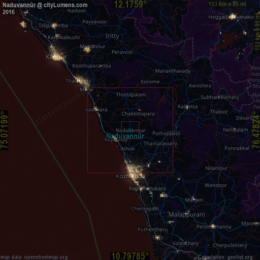
Analysis of Naduvannūr night lights 2016
Square area 10x10 km:
 0%
0%90-99
0%80-89
0%70-79
0%60-69
0%50-59
0%40-49
0%30-39
0%20-29
0%10-19
0%0-9
100%Square area 50x50 km:
0%90-99
0.02%80-89
0.28%70-79
0.23%60-69
0.18%50-59
0.5%40-49
0.49%30-39
0.35%20-29
0.52%10-19
1.27%0-9
96.17%Clear (daylight) street map image can be seen on geolist.org.
Map coordinates:
12° 10' 33.2" North, 75° 4' 19.2" East
11° 29' 15.8" North, 75° 46' 30.4" East
10° 47' 52.3" North, 76° 28' 41.7" East
Some cities around Naduvannūr sort by population:
• Kozhikode
26.7 km =16.6 mi,  178°
178°
• Badagara
24.4 km =15.2 mi,  300°
300°
• Beypore
35.3 km =21.9 mi,  174°
174°
• Nādāpuram
25.5 km =15.8 mi,  329°
329°
• Kunnamangalam
23.2 km =14.4 mi,  151°
151°
• Ferokh
35 km =21.7 mi, 168°
• Mavoor
29 km =18 mi, 147°
• Iringal
19 km =11.8 mi,  294°
294°
1262285 (p: 24,648)
Sources (retrieved 2019-11-25):
» Earth at Night: Flat Maps 2012, 2016