Ferokh night lights from space
Night Light of Ferokh (Kerala) from space (India) Src. Average luminocity for 10x10km area is 11.3874% and for 50x50km: 3.1738%.
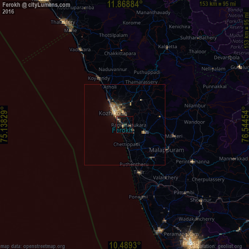
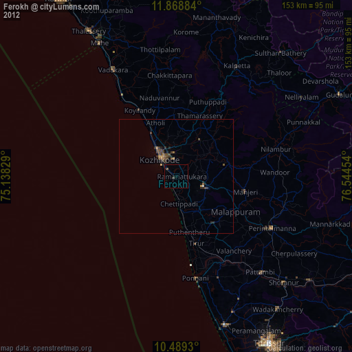
Analysis of Ferokh night lights 2016
Square area 10x10 km:
 0%
0%90-99
0%80-89
0.87%70-79
0.87%60-69
0%50-59
4.33%40-49
3.68%30-39
2.16%20-29
4.98%10-19
14.94%0-9
68.18%Square area 50x50 km:
0%90-99
0.06%80-89
0.59%70-79
0.42%60-69
0.43%50-59
0.86%40-49
0.82%30-39
0.61%20-29
0.71%10-19
2.89%0-9
92.59%Clear (daylight) street map image can be seen on geolist.org.
Map coordinates:
11° 52' 7.8" North, 75° 8' 17.8" East
11° 10' 47.6" North, 75° 50' 29.1" East
10° 29' 21.5" North, 76° 32' 40.3" East
Some cities around Ferokh sort by population:
• Kozhikode
10.1 km =6.3 mi,  318°
318°
• Manjeri
31.1 km =19.3 mi,  102°
102°
• Beypore
4 km =2.5 mi,  256°
256°
• Malappuram
30.4 km =18.9 mi,  120°
120°
• Tirur
30.9 km =19.2 mi,  163°
163°
• Kunnamangalam
14.4 km =8.9 mi,  15°
15°
• Mavoor
12.7 km =7.9 mi,  40°
40°
• Pariyāpuram
18.4 km =11.4 mi,  171°
171°
1271888 (p: 30,229)
Sources (retrieved 2019-11-25):
» Earth at Night: Flat Maps 2012, 2016