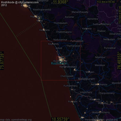
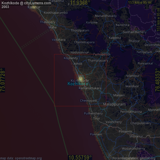
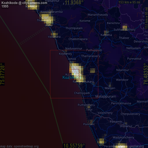
Kozhikode night lights from space
Night Light of Kozhikode (Kerala) from space (India) Src. Average luminocity for 10x10km area is 39.4307% and for 50x50km: 3.1617%.
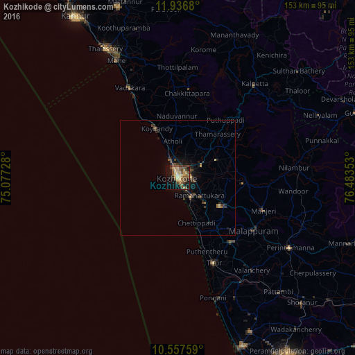
Analysis of Kozhikode night lights 2016
Square area 10x10 km:
 0%
0%90-99
1.08%80-89
11.26%70-79
8.23%60-69
6.06%50-59
14.29%40-49
9.31%30-39
3.9%20-29
1.95%10-19
30.09%0-9
13.85%Square area 50x50 km:
0%90-99
0.06%80-89
0.59%70-79
0.39%60-69
0.43%50-59
0.86%40-49
0.79%30-39
0.64%20-29
0.82%10-19
2.82%0-9
92.59%Clear (daylight) street map image can be seen on geolist.org.
Map coordinates:
11° 56' 12.5" North, 75° 4' 38.2" East
11° 14' 52.9" North, 75° 46' 49.4" East
10° 33' 27.3" North, 76° 29' 0.7" East
Some cities around Kozhikode sort by population:
• Manjeri
39.7 km =24.7 mi,  110°
110°
• Beypore
9 km =5.6 mi,  161°
161°
• Kunnamangalam
12.3 km =7.6 mi,  59°
59°
• Ferokh
10.1 km =6.3 mi,  138°
138°
• Mavoor
15 km =9.3 mi,  82°
82°
• Naduvannūr
26.7 km =16.6 mi,  358°
358°
• Iringal
38.9 km =24.2 mi,  332°
332°
• Pariyāpuram
27.4 km =17 mi, 159°
1265873 (p: 439,922)
Sources (retrieved 2019-11-25):
» NASA, Earths city lights 1995
» NASA city lights 2003
» Earth at Night: Flat Maps 2012, 2016