Nadīgaon night lights from space
Night Light of Nadīgaon (Uttar Pradesh) from space (India) Src. Average luminocity for 10x10km area is 5.0337% and for 50x50km: 4.7599%.
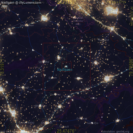
Analysis of Nadīgaon night lights 2016
Square area 10x10 km:
 0.6%
0.6%90-99
0.99%80-89
0%70-79
0%60-69
0.79%50-59
0%40-49
0.79%30-39
1.19%20-29
3.57%10-19
2.38%0-9
89.68%Square area 50x50 km:
0.39%90-99
0.66%80-89
0.36%70-79
0.32%60-69
0.54%50-59
0.62%40-49
0.92%30-39
1.21%20-29
1.5%10-19
1%0-9
92.48%Clear (daylight) street map image can be seen on geolist.org.
Map coordinates:
26° 44' 15" North, 78° 19' 11" East
26° 6' 28.2" North, 79° 1' 22.2" East
25° 28' 29.1" North, 79° 43' 33.5" East
Some cities around Nadīgaon sort by population:
• Konch
18 km =11.2 mi,  134°
134°
• Lahār
12.6 km =7.8 mi,  319°
319°
• Seondha
24.7 km =15.3 mi,  282°
282°
• Daboh
18.7 km =11.6 mi,  231°
231°
• Mihona
20 km =12.4 mi,  347°
347°
• Rāmpura
31.2 km =19.4 mi,  30°
30°
• Mādhogarh
24.7 km =15.3 mi,  41°
41°
• Alampur
24.4 km =15.2 mi,  247°
247°
1262291 (p: 7,597)
Sources (retrieved 2019-11-25):
» Earth at Night: Flat Maps 2012, 2016