Musiri night lights from space
Night Light of Musiri (Tamil Nadu) from space (India) Src. Average luminocity for 10x10km area is 20.3874% and for 50x50km: 7.4382%.
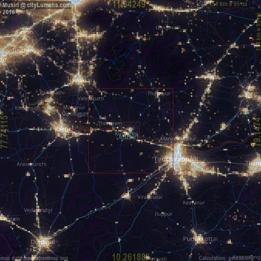
Analysis of Musiri night lights 2016
Square area 10x10 km:
 0%
0%90-99
1.73%80-89
2.6%70-79
3.03%60-69
2.6%50-59
5.41%40-49
5.41%30-39
4.55%20-29
5.84%10-19
12.34%0-9
56.49%Square area 50x50 km:
0.15%90-99
0.84%80-89
0.63%70-79
1.04%60-69
1.18%50-59
0.96%40-49
2.11%30-39
2.01%20-29
3.03%10-19
3.55%0-9
84.49%Clear (daylight) street map image can be seen on geolist.org.
Map coordinates:
11° 38' 33" North, 77° 44' 28.1" East
10° 57' 10.8" North, 78° 26' 39.4" East
10° 15' 42.8" North, 79° 8' 50.6" East
Some cities around Musiri sort by population:
• Tiruchirappalli
31.5 km =19.6 mi,  119°
119°
• Turaiyūr
27.6 km =17.1 mi,  37°
37°
• Kulittalai
4 km =2.5 mi,  239°
239°
• Tāttayyangārpettai
19 km =11.8 mi,  1°
1°
• Kāttupputtūr
25 km =15.5 mi,  280°
280°
• Mettuppālaiyam
23.9 km =14.9 mi, 1°
• Erumaippatti
27.3 km =17 mi,  321°
321°
• Puduppatti
33.7 km =20.9 mi,  311°
311°
1262380 (p: 30,209)
Sources (retrieved 2019-11-25):
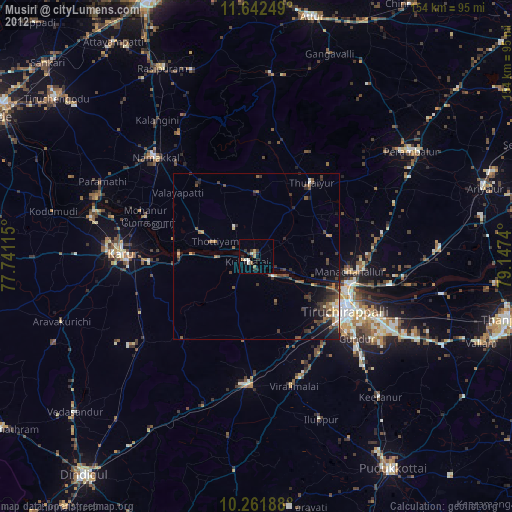
» Earth at Night: Flat Maps 2012, 2016