Turaiyūr night lights from space
Night Light of Turaiyūr (Tamil Nadu) from space (India) Src. Average luminocity for 10x10km area is 11.3074% and for 50x50km: 4.4962%.
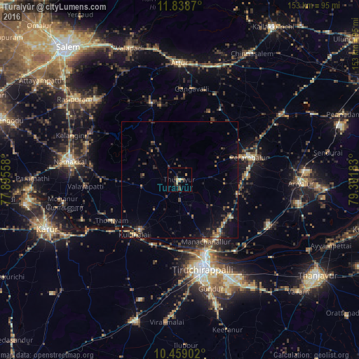
Analysis of Turaiyūr night lights 2016
Square area 10x10 km:
 0%
0%90-99
1.52%80-89
1.52%70-79
2.16%60-69
0.87%50-59
0.87%40-49
2.6%30-39
4.11%20-29
5.41%10-19
1.08%0-9
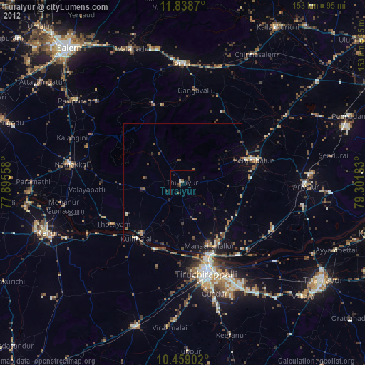
79.87%Square area 50x50 km:
0%90-99
0.37%80-89
0.36%70-79
0.65%60-69
0.37%50-59
0.75%40-49
1.16%30-39
1.37%20-29
1.61%10-19
3.01%0-9
90.35%Clear (daylight) street map image can be seen on geolist.org.
Map coordinates:
11° 50' 19.3" North, 77° 53' 44.1" East
11° 8' 58.8" North, 78° 35' 55.3" East
10° 27' 32.5" North, 79° 18' 6.6" East
Some cities around Turaiyūr sort by population:
• Perambalur
32.4 km =20.1 mi,  73°
73°
• Musiri
27.6 km =17.1 mi,  217°
217°
• Kulittalai
31.4 km =19.5 mi, 220°
• Tāttayyangārpettai
16.6 km =10.3 mi,  260°
260°
• Arumbāvūr
29.4 km =18.3 mi,  29°
29°
• Mettuppālaiyam
16.4 km =10.2 mi,  277°
277°
• Erumaippatti
33.7 km =20.9 mi,  269°
269°
• Uppiliyapuram
15.7 km =9.8 mi,  323°
323°
1254043 (p: 32,134)
Sources (retrieved 2019-11-25):
» Earth at Night: Flat Maps 2012, 2016