Murbād night lights from space
Night Light of Murbād (Maharashtra) from space (India) Src. Average luminocity for 10x10km area is 19.1905% and for 50x50km: 16.5795%.
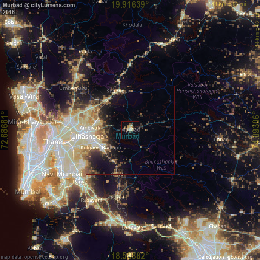
Analysis of Murbād night lights 2016
Square area 10x10 km:
 0%
0%90-99
4.33%80-89
3.9%70-79
1.3%60-69
2.6%50-59
3.46%40-49
2.38%30-39
2.38%20-29
2.16%10-19
8.01%0-9
69.48%Square area 50x50 km:
1.19%90-99
2.99%80-89
2.78%70-79
2.34%60-69
2.37%50-59
2.69%40-49
2.86%30-39
3.15%20-29
4.2%10-19
8.72%0-9
66.7%Clear (daylight) street map image can be seen on geolist.org.
Map coordinates:
19° 54' 59" North, 72° 41' 12.5" East
19° 15' 14.2" North, 73° 23' 23.7" East
18° 35' 19.8" North, 74° 5' 35" East
Some cities around Murbād sort by population:
• Kalyān
26.7 km =16.6 mi,  267°
267°
• Dombivli
32.5 km =20.2 mi,  262°
262°
• Ulhasnagar
25.5 km =15.8 mi, 260°
• Amarnāth
24.2 km =15 mi, 255°
• Badlapur
17.1 km =10.6 mi,  229°
229°
• Vasind
21.7 km =13.5 mi,  322°
322°
• Neral
26.6 km =16.5 mi,  196°
196°
• Shāhāpur
23.1 km =14.4 mi,  343°
343°
1262444 (p: 17,494)
Sources (retrieved 2019-11-25):
» Earth at Night: Flat Maps 2012, 2016