Chirgaon night lights from space
Night Light of Chirgaon (Uttar Pradesh) from space (India) Src. Average luminocity for 10x10km area is 22.1818% and for 50x50km: 15.1154%.
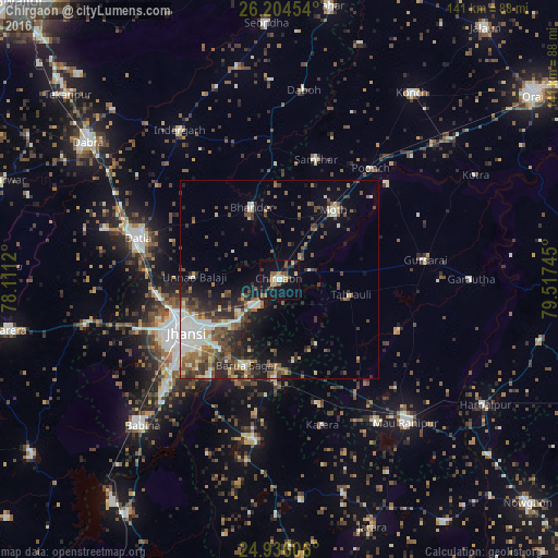
Analysis of Chirgaon night lights 2016
Square area 10x10 km:
 1.89%
1.89%90-99
1.89%80-89
2.27%70-79
3.41%60-69
3.41%50-59
4.73%40-49
2.46%30-39
3.41%20-29
2.46%10-19
30.49%0-9
43.56%Square area 50x50 km:
1.6%90-99
3.23%80-89
1.09%70-79
1.14%60-69
2.04%50-59
2.93%40-49
2.88%30-39
3.31%20-29
3.66%10-19
7.53%0-9
70.59%Clear (daylight) street map image can be seen on geolist.org.
Map coordinates:
26° 12' 16.3" North, 78° 6' 40.3" East
25° 34' 19.1" North, 78° 48' 51.6" East
24° 56' 9.8" North, 79° 31' 2.8" East
Some cities around Chirgaon sort by population:
• Jhānsi
26.7 km =16.6 mi,  241°
241°
• Bhānder
19.5 km =12.1 mi,  339°
339°
• Samthar
31.6 km =19.6 mi,  17°
17°
• Moth
21.9 km =13.6 mi,  38°
38°
• Tori-Fatehpur
32.8 km =20.4 mi,  113°
113°
• Barāgaon
14.8 km =9.2 mi,  223°
223°
• Orchha
30.1 km =18.7 mi, 215°
• Pārīchha
9 km =5.6 mi, 217°
1274099 (p: 14,147)
Sources (retrieved 2019-11-25):
» Earth at Night: Flat Maps 2012, 2016