Madurai night lights from space
Night Light of Madurai (Tamil Nadu) from space (India) Src. Average luminocity for 10x10km area is 89.5145% and for 50x50km: 14.8527%.
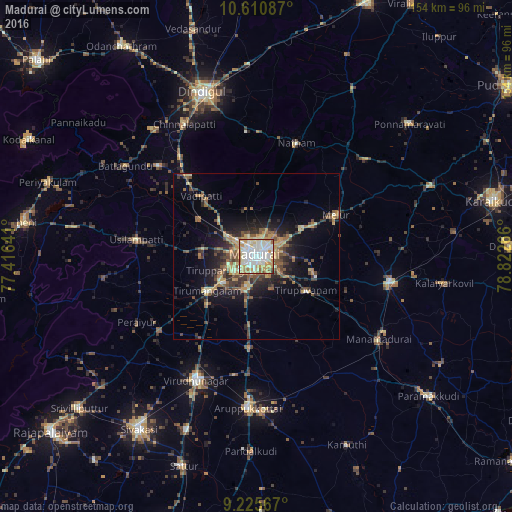
Analysis of Madurai night lights 2016
Square area 10x10 km:
 30.17%
90-99
33.47%80-89
11.36%70-79
17.15%60-69
4.34%50-59
2.48%40-49
0.83%30-39
0.21%20-29
0%10-19
0%0-9
0%Square area 50x50 km:
1.27%90-99
1.99%80-89
1.72%70-79
2.76%60-69
1.94%50-59
2.67%40-49
2.61%30-39
2.95%20-29
3.89%10-19
7.78%0-9
70.42%Clear (daylight) street map image can be seen on geolist.org.
Map coordinates:
10° 36' 39.1" North, 77° 24' 59.1" East
9° 55' 8.4" North, 78° 7' 10.3" East
9° 13' 32.4" North, 78° 49' 21.6" East
Some cities around Madurai sort by population:
• Tirupparangunram
6.6 km =4.1 mi,  230°
230°
• Melur
27.2 km =16.9 mi,  62°
62°
• Tiruppuvanam
18.4 km =11.4 mi,  124°
124°
• Vādippatti
25.3 km =15.7 mi,  316°
316°
• Kariapatti
27.2 km =16.9 mi,  184°
184°
• Alangānallūr
14.6 km =9.1 mi,  347°
347°
• Kallupatti
35.7 km =22.2 mi, 230°
• Pālamedu
20.7 km =12.9 mi,  358°
358°
1264521 (p: 909,908)
Sources (retrieved 2019-11-25):
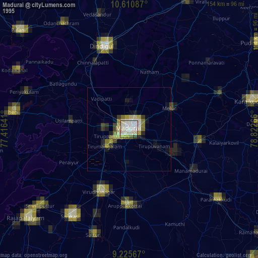
» NASA, Earths city lights 1995
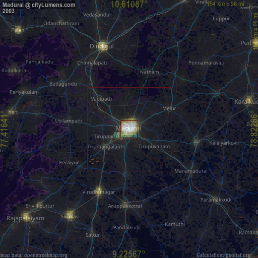
» NASA city lights 2003
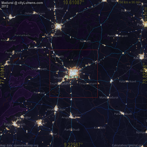
» Earth at Night: Flat Maps 2012, 2016