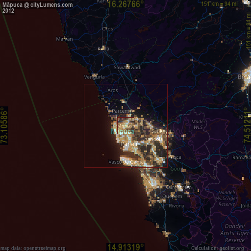
Māpuca night lights from space
Night Light of Māpuca (Goa) from space (India) Src. Average luminocity for 10x10km area is 82.2078% and for 50x50km: 29.483%.
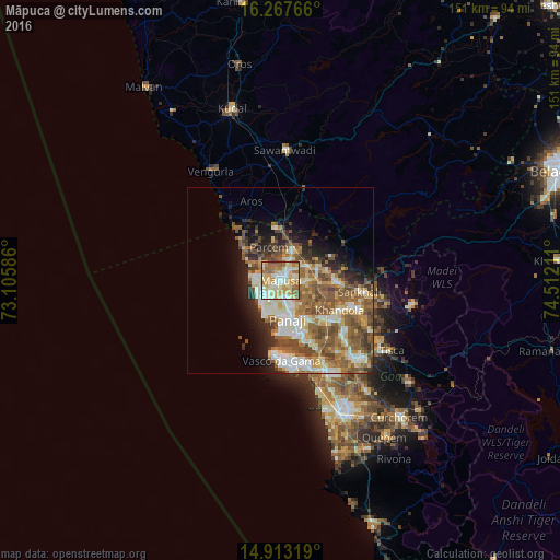
Analysis of Māpuca night lights 2016
Square area 10x10 km:
100  10.82%
90-99 28.79%
80-89 24.46%
70-79 12.55%
60-69 14.29%
50-59 8.23%
40-49 0.87%
30-39 0%
20-29 0%
10-19 0%
0-9 0%
10.82%90-99
28.79%80-89
24.46%70-79
12.55%60-69
14.29%50-59
8.23%40-49
0.87%30-39
0%20-29
0%10-19
0%0-9
0%Square area 50x50 km:
100 3.55%
90-99 7.03%
80-89 4.27%
70-79 3.2%
60-69 5.64%
50-59 7.23%
40-49 5.18%
30-39 2.81%
20-29 4.1%
10-19 6.27%
0-9 50.71%
3.55%90-99
7.03%80-89
4.27%70-79
3.2%60-69
5.64%50-59
7.23%40-49
5.18%30-39
2.81%20-29
4.1%10-19
6.27%0-9
50.71%Clear (daylight) street map image can be seen on geolist.org.
Map coordinates:
16° 16' 3.6" North, 73° 6' 21.1" East
15° 35' 29.5" North, 73° 48' 32.3" East
14° 54' 47.5" North, 74° 30' 43.6" East
Some cities around Māpuca sort by population:
• Calangute
7.8 km =4.8 mi,  227°
227°
• Vagator
6.9 km =4.3 mi,  275°
275°
• Serula
6.1 km =3.8 mi,  142°
142°
• Solim
5.2 km =3.2 mi,  300°
300°
• Guirim
1.8 km =1.1 mi,  186°
186°
• Aldona
7.1 km =4.4 mi,  88°
88°
• Saligao
4.7 km =2.9 mi,  205°
205°
• Colovale
5.1 km =3.2 mi,  18°
18°
1263580 (p: 40,122)
Sources (retrieved 2019-11-25):
» Earth at Night: Flat Maps 2012, 2016