Manihāri night lights from space
Night Light of Manihāri (Bihar) from space (India) Src. Average luminocity for 10x10km area is 6.998% and for 50x50km: 8.2924%.
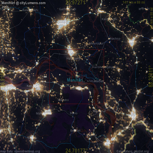
Analysis of Manihāri night lights 2016
Square area 10x10 km:
 0%
0%90-99
0%80-89
0.79%70-79
0%60-69
0%50-59
3.97%40-49
2.38%30-39
2.38%20-29
1.79%10-19
0.99%0-9
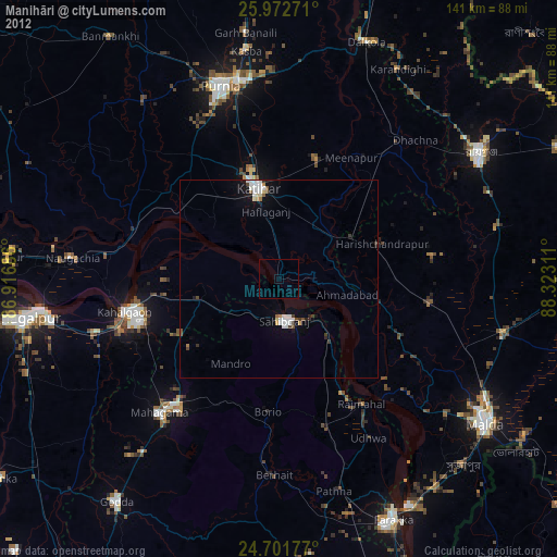
87.7%Square area 50x50 km:
0.93%90-99
0.9%80-89
0.49%70-79
0.62%60-69
0.76%50-59
1.41%40-49
1.75%30-39
2.08%20-29
2.53%10-19
5.36%0-9
83.17%Clear (daylight) street map image can be seen on geolist.org.
Map coordinates:
25° 58' 21.8" North, 86° 55' 0.7" East
25° 20' 20.1" North, 87° 37' 11.9" East
24° 42' 6.4" North, 88° 19' 23.2" East
Some cities around Manihāri sort by population:
• Purnia
51.1 km =31.8 mi,  343°
343°
• Katihar
22.7 km =14.1 mi,  347°
347°
• Sāhibganj
10.6 km =6.6 mi,  171°
171°
• Naugachhia
52.6 km =32.7 mi,  275°
275°
• Kasba
58.1 km =36.1 mi, 351°
• Colgong
39.8 km =24.7 mi,  257°
257°
• Rājmahal
38.2 km =23.7 mi,  146°
146°
• Raghunāthpur
45.3 km =28.1 mi,  41°
41°
1263723 (p: 23,731)
Sources (retrieved 2019-11-25):
» Earth at Night: Flat Maps 2012, 2016