Mangalore night lights from space
Night Light of Mangalore (Karnataka) from space (India) Src. Average luminocity for 10x10km area is 89.1948% and for 50x50km: 17.6261%.
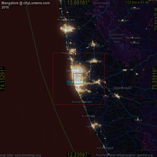
Analysis of Mangalore night lights 2016
Square area 10x10 km:
 18.4%
18.4%90-99
33.55%80-89
33.33%70-79
6.06%60-69
6.28%50-59
1.52%40-49
0.87%30-39
0%20-29
0%10-19
0%0-9
0%Square area 50x50 km:
1.71%90-99
3.14%80-89
3.93%70-79
1.4%60-69
2.16%50-59
2.67%40-49
2.99%30-39
2.82%20-29
4.7%10-19
9.31%0-9
65.17%Clear (daylight) street map image can be seen on geolist.org.
Map coordinates:
13° 36' 5.8" North, 74° 9' 10.5" East
12° 55' 2" North, 74° 51' 21.7" East
12° 13' 51.5" North, 75° 33' 33" East
Some cities around Mangalore sort by population:
• Udupi
47.9 km =29.8 mi,  345°
345°
• Ullal
12.4 km =7.7 mi,  177°
177°
• Puttūr
41.4 km =25.7 mi,  115°
115°
• Bantvāl
19.6 km =12.2 mi,  98°
98°
• Mūdbidri
22.4 km =13.9 mi,  42°
42°
• Kārkala
36.2 km =22.5 mi,  24°
24°
• Mūlki
20.5 km =12.7 mi,  340°
340°
• Manjēshvar
23 km =14.3 mi,  171°
171°
1263780 (p: 417,387)
Sources (retrieved 2019-11-25):
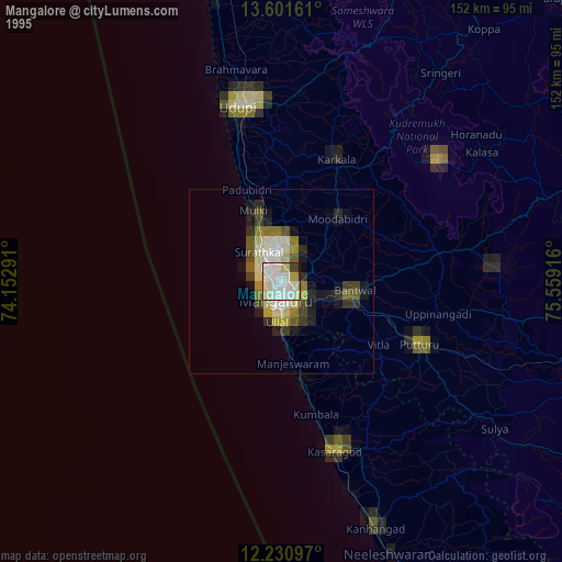
» NASA, Earths city lights 1995
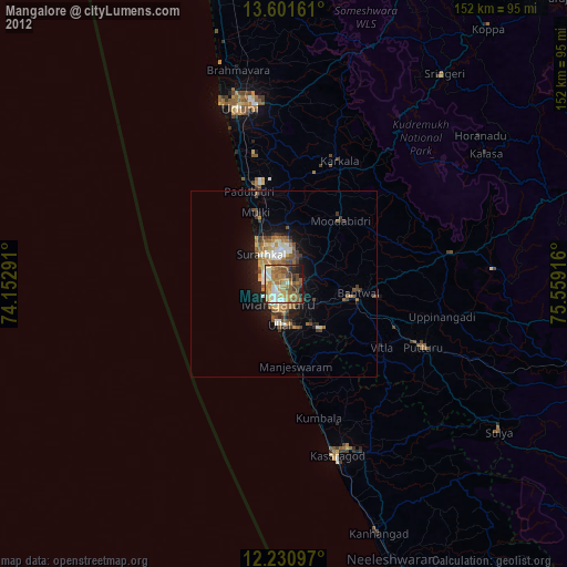
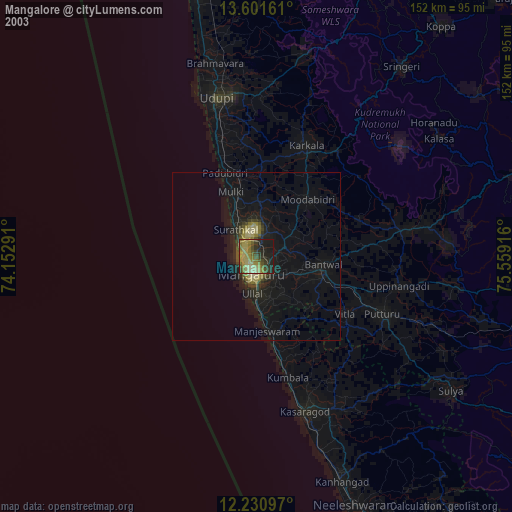
» NASA city lights 2003
» Earth at Night: Flat Maps 2012, 2016