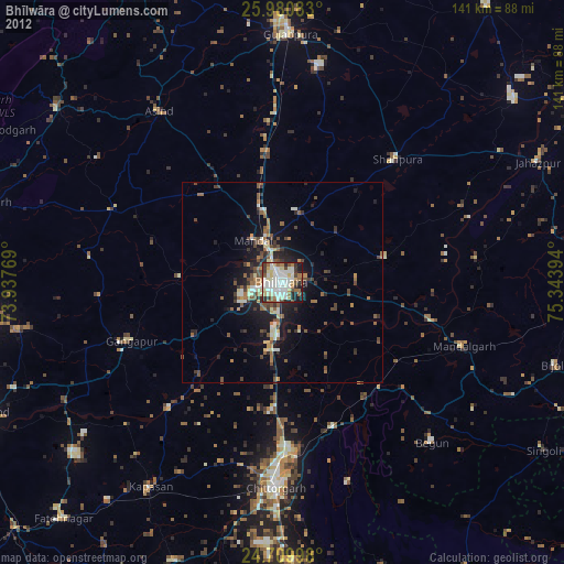
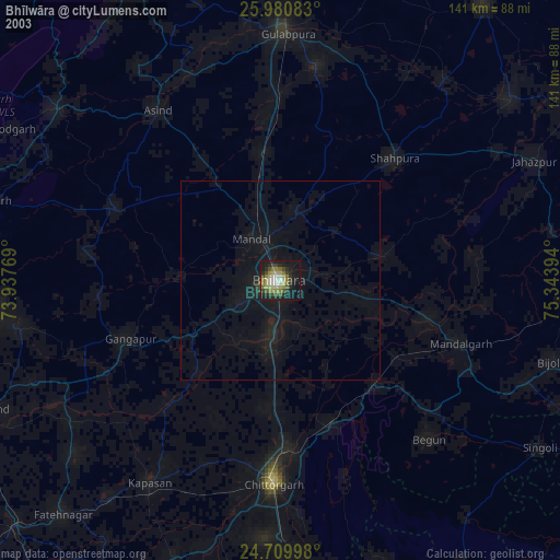
Bhīlwāra night lights from space
Night Light of Bhīlwāra (Rajasthan) from space (India) Src. Average luminocity for 10x10km area is 83.6171% and for 50x50km: 13.2212%.
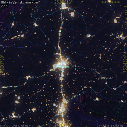

Analysis of Bhīlwāra night lights 2016
Square area 10x10 km:
 24.6%
24.6%90-99
36.31%80-89
4.76%70-79
8.13%60-69
8.33%50-59
8.53%40-49
6.15%30-39
1.59%20-29
1.59%10-19
0%0-9
0%Square area 50x50 km:
1.2%90-99
3.04%80-89
1.18%70-79
1.34%60-69
1.36%50-59
2.2%40-49
2.49%30-39
2.25%20-29
4.61%10-19
8.12%0-9
72.21%Clear (daylight) street map image can be seen on geolist.org.
Map coordinates:
25° 58' 51" North, 73° 56' 15.7" East
25° 20' 49.5" North, 74° 38' 26.9" East
24° 42' 35.9" North, 75° 20' 38.2" East
Some cities around Bhīlwāra sort by population:
• Chittaurgarh
50.9 km =31.6 mi,  181°
181°
• Shāhpura
41.7 km =25.9 mi,  43°
43°
• Gulābpura
62 km =38.5 mi,  1°
1°
• Māndal
12.7 km =7.9 mi,  325°
325°
• Māndalgarh
46.6 km =29 mi,  111°
111°
• Begūn
54.2 km =33.7 mi,  138°
138°
• Gangāpur
40.8 km =25.4 mi,  249°
249°
• Āsind
53 km =32.9 mi,  324°
324°
1275960 (p: 326,431)
Sources (retrieved 2019-11-25):
» NASA, Earths city lights 1995
» NASA city lights 2003
» Earth at Night: Flat Maps 2012, 2016