Majholi night lights from space
Night Light of Majholi (Madhya Pradesh) from space (India) Src. Average luminocity for 10x10km area is 8.123% and for 50x50km: 10.8634%.
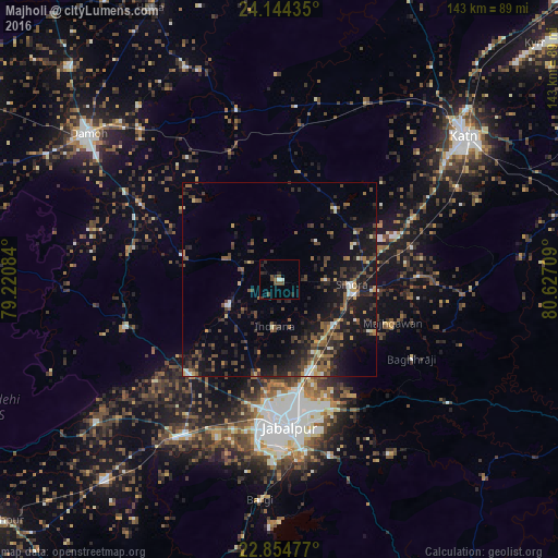
Analysis of Majholi night lights 2016
Square area 10x10 km:
 0.4%
0.4%90-99
1.19%80-89
0%70-79
0%60-69
0.2%50-59
2.78%40-49
3.57%30-39
0.4%20-29
5.16%10-19
0.4%0-9
85.91%Square area 50x50 km:
0.44%90-99
0.88%80-89
0.83%70-79
0.74%60-69
1.24%50-59
2.49%40-49
2.74%30-39
2.95%20-29
4.43%10-19
10.87%0-9
72.39%Clear (daylight) street map image can be seen on geolist.org.
Map coordinates:
24° 8' 39.7" North, 79° 13' 15" East
23° 30' 4.1" North, 79° 55' 26.3" East
22° 51' 17.2" North, 80° 37' 37.5" East
Some cities around Majholi sort by population:
• Jabalpur
37.3 km =23.2 mi,  175°
175°
• Sihorā
18.4 km =11.4 mi,  94°
94°
• Panāgar
25.1 km =15.6 mi,  163°
163°
• Kaimori
22.5 km =14 mi,  234°
234°
• Katangi
14.6 km =9.1 mi,  242°
242°
• Khamaria
31 km =19.3 mi,  188°
188°
• Pātan
33.8 km =21 mi, 225°
• Tendūkheda
40.9 km =25.4 mi,  253°
253°
1264244 (p: 11,553)
Sources (retrieved 2019-11-25):
» Earth at Night: Flat Maps 2012, 2016