Jabalpur night lights from space
Night Light of Jabalpur (Madhya Pradesh) from space (India) Src. Average luminocity for 10x10km area is 98.4432% and for 50x50km: 26.7943%.
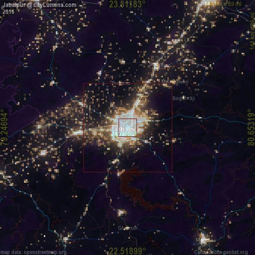
Analysis of Jabalpur night lights 2016
Square area 10x10 km:
 71.78%
90-99
23.86%80-89
1.89%70-79
1.33%60-69
0.76%50-59
0.38%40-49
0%30-39
0%20-29
0%10-19
0%0-9
0%Square area 50x50 km:
5.84%90-99
4.25%80-89
2.03%70-79
2.24%60-69
3.29%50-59
4.79%40-49
4.83%30-39
5.38%20-29
7.74%10-19
11.53%0-9
48.07%Clear (daylight) street map image can be seen on geolist.org.
Map coordinates:
23° 48' 42.6" North, 79° 14' 49" East
23° 10' 1.1" North, 79° 57' 0.2" East
22° 31' 8.4" North, 80° 39' 11.5" East
Some cities around Jabalpur sort by population:
• Panāgar
13.9 km =8.6 mi,  19°
19°
• Kaimori
32.1 km =19.9 mi,  319°
319°
• Katangi
34.3 km =21.3 mi,  332°
332°
• Bargi
21 km =13 mi,  201°
201°
• Khamaria
9.7 km =6 mi,  312°
312°
• Pātan
29.7 km =18.5 mi,  296°
296°
• Shāhpura
29.4 km =18.3 mi,  263°
263°
• Barela
12.9 km =8 mi,  127°
127°
1269633 (p: 1,030,168)
Sources (retrieved 2019-11-25):
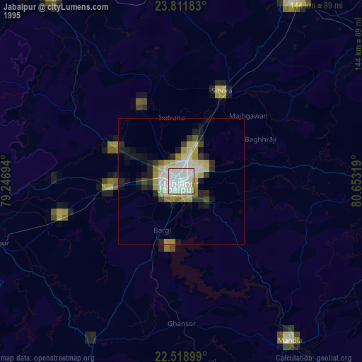
» NASA, Earths city lights 1995
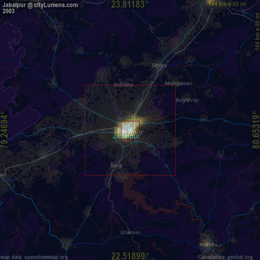
» NASA city lights 2003
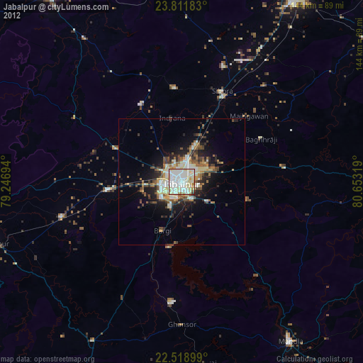
» Earth at Night: Flat Maps 2012, 2016